Home Monument types Hillfort
What is a hillfort?
A hillfort is an enclosure on a hilltop, ridge or promontory, bounded by one or more banks, ramparts and ditches. Most were built and occupied in the Late Bronze Age and Iron Age.
- Period
- Late Bronze Age and Iron Age, about 900 BC to the 1st century AD; many were reused later.
- Also called
- hill fort, promontory fort, contour fort, cliff castle, camp, caer or gaer (Welsh)
- Pages on Waystone
- 306 in England and Wales
What a hillfort is
Historic England's introduction to hillforts dates their building and occupation to about 900 to 100 BC, and its scheduling texts date some large multivallate hillforts into the mid-1st century AD; many were reused later, for example as medieval castles. Historic England classes hillforts by size and number of ramparts: slight univallate and large univallate hillforts usually enclose 1 to 10 hectares, while large multivallate hillforts enclose 5 to 85 hectares within two or more concentric lines of earthworks. Promontory forts have one or more ramparts across the neck of a spur or headland, with steep slopes or cliffs forming the rest of the boundary. The Atlas of Hillforts of Britain and Ireland, published in 2017, records 4,147 hillforts across Britain and Ireland, and their size, defensive strength and evidence of occupation vary greatly.
How hillforts look on LiDAR
Hillforts are among the clearest monuments on a bare-earth terrain model: the ramparts show as continuous banks with ditches outside them, following the contour of the hill, and the model shows them under woodland where aerial photographs cannot. Hillshade gives the most readable overall picture, but a rampart that runs parallel to the direction of the light can disappear, so hillshade from several directions or a local relief model is more reliable. Sky-view factor and negative openness pick out the ditches and the entrance gaps, and positive openness shows the crest lines of the ramparts. A local relief model also shows low features in the interior, such as house platforms and quarry hollows, where they survive.
See LiDAR visualisations explained for what each method shows.
What can look like one
Natural scarps, river terraces and the back-scarps of landslips can look like a single rampart, and later field banks, plantation banks and quarry edges can appear to complete a circuit. Medieval ringworks and later stock enclosures are usually smaller but can look similar.
Protection
Many hillforts are scheduled monuments, protected in England by the Ancient Monuments and Archaeological Areas Act 1979 and in Wales by the Historic Environment (Wales) Act 2023.
Examples on the LiDAR
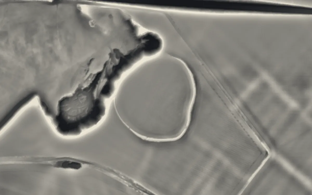 Maiden Bower hillfortBedfordshire
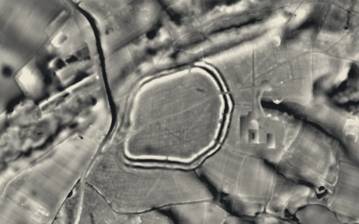 Bussock CampBerkshire
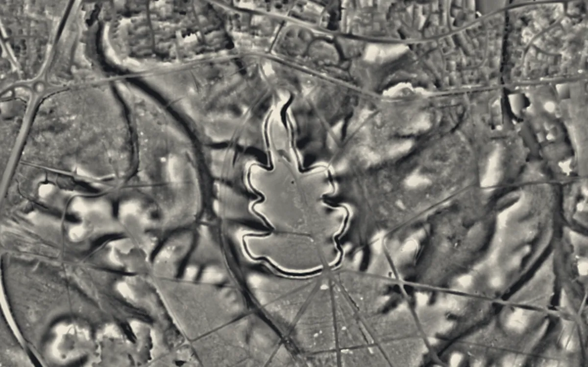 Caesar's Camp, Bracknell ForestBerkshire
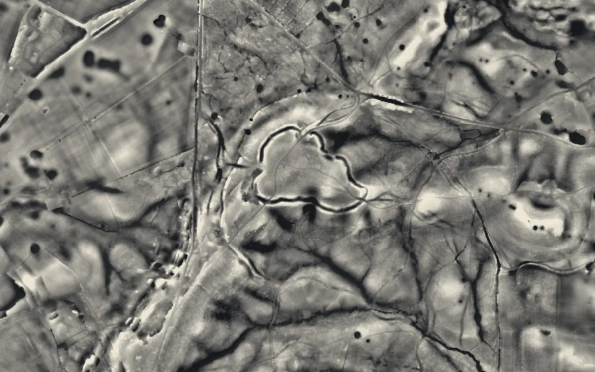 Grimsbury CastleBerkshire
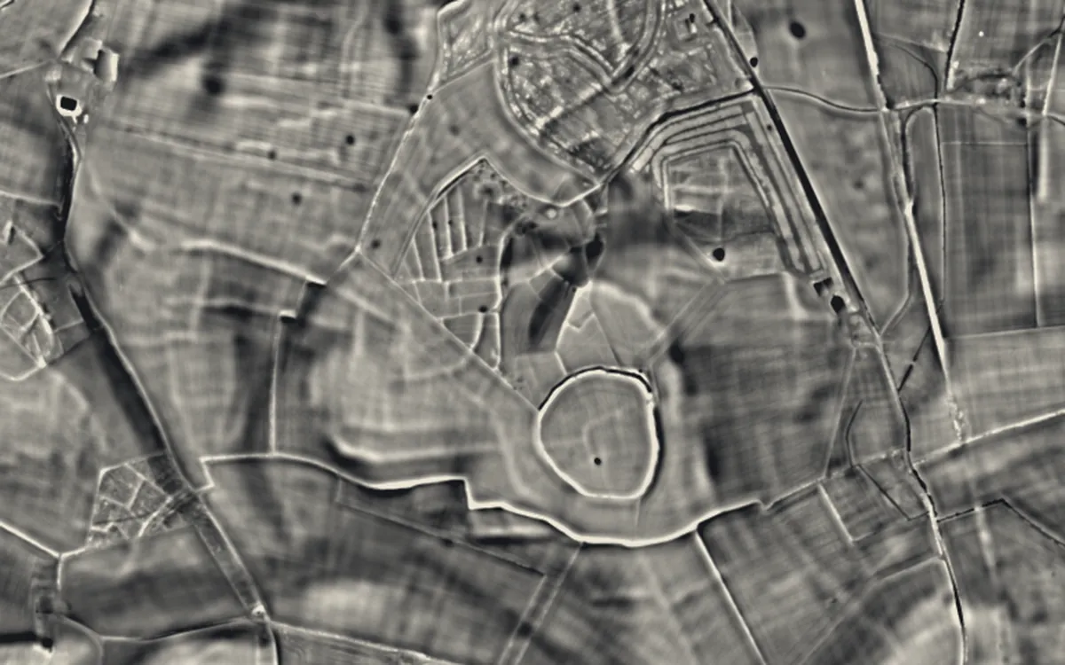 Perborough CastleBerkshire
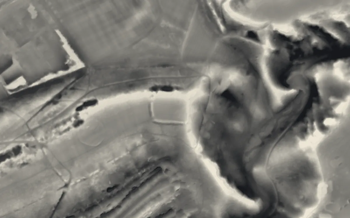 Kingsweston HillBristol
Where they are
Counties with the most hillforts that have a page here.
- Somerset56 with a page
- Devon40 with a page
- Wiltshire20 with a page
- Hampshire19 with a page
- Cornwall17 with a page
- Dorset17 with a page
- Herefordshire10 with a page
- Powys10 with a page
- Cheshire8 with a page
- Oxfordshire7 with a page
- Shropshire7 with a page
- Denbighshire6 with a page
- Gwynedd6 with a page
- Conwy5 with a page
- Staffordshire5 with a page
- West Sussex5 with a page
- Berkshire4 with a page
- Northumberland4 with a page
- Cambridgeshire3 with a page
- Cardiff3 with a page
- Ceredigion3 with a page
- Essex3 with a page
- Flintshire3 with a page
- Gloucestershire3 with a page
More examples
- Boddington Camp: a slight univallate hillfort on the summit of Boddington HillBuckinghamshire
- Cholesbury CampBuckinghamshire
- TwmbarlwmCaerphilly
- Belsar's HillCambridgeshire
- Stonea CampCambridgeshire
- Wandlebury Hill FortCambridgeshire
- Caerau HillfortCardiff
- Llwynda'-dduCardiff
- Wenallt CampCardiff
- Craig GwrtheyrnCarmarthenshire
- Llansteffan CastleCarmarthenshire
- Castell NadoligCeredigion
- Gaer FawrCeredigion
- Hen Gaer, Bow StreetCeredigion
- Bradley hill fortCheshire
- Burton PointCheshire
- Eddisbury hill fortCheshire
- Helsby hill fortCheshire
- Kelsborrow CastleCheshire
- Maiden CastleCheshire
- Oakmere hill fortCheshire
- Woodhouse Hill CampCheshire
- Caer BachConwy
- Castell Caer SeionConwy
- Castell CawrConwy
- Mynydd y GaerConwy
- Pen y GaerConwy
- Black HeadCornwall
- Cadson BuryCornwall
- Castle DoreCornwall
Sources
- FISH Thesaurus of Monument Types (Historic England): Hillfort
- FISH Thesaurus of Monument Types (Historic England): Promontory Fort
- Monument Type Thesaurus (Wales), RCAHMW: Hillfort
- Historic England, Introductions to Heritage Assets: Hillforts (2018)
- Historic England, National Heritage List entry 1013608: Portfield hillfort (reasons for designation: hillfort classes)
- Historic England, National Heritage List entry 1009396: Borough Hill: a large multivallate hillfort
- Wikipedia: Atlas of Hillforts of Britain and Ireland (cross-check)
- Wikipedia: Hillfort (cross-check)
- Relief Visualization Toolbox documentation: Hillshading
- Relief Visualization Toolbox documentation: Openness
Last updated 2026-10-16.