Home LiDAR map England Cheshire
LiDAR map of Cheshire
Waystone shows the bare-earth LiDAR of Cheshire at one metre per pixel, with the 4,033 recorded historic places the heritage records hold here, the Roman roads and the Ordnance Survey six-inch maps of 1843–1913 over the same ground. Free, in a browser.
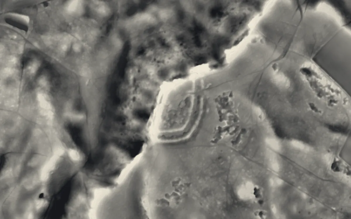
Places on the LiDAR in Cheshire
Each page shows the site on the LiDAR with its record, its location and the recorded places around it.
- Aldford CastleMotte and bailey
- Anderton Boat LiftScheduled monument
- Beeston CastleCastle
- Bradley hill fortHillfort
- Burton PointHillfort
- Chester Roman AmphitheatreRoman site
- Chester city wallsScheduled monument
- Chorley Old HallScheduled monument
- DaresburyScheduled monument
- Dodleston CastleMotte and bailey
- Eddisbury hill fortHillfort
- Hale Duck DecoyScheduled monument
- Halton CastleCastle
- Helsby hill fortHillfort
- Heronbridge Roman SiteScheduled monument
- Holford HallScheduled monument
- Ince ManorScheduled monument
- Kelsborrow CastleHillfort
- Kingsley CastleMotte and bailey
- Lion Salt WorksScheduled monument
- Little Moreton HallManor house
- Lower Huxley HallScheduled monument
- Lymm HallScheduled monument
- Maiden CastleHillfort
- Minerva's Shrine, ChesterScheduled monument
- Norton Priory Museum and GardensAbbey
- Oakmere hill fortHillfort
- Old Dee BridgeBridge
- Pulford CastleMotte and bailey
- Sandbach CrossesCross
- Shotwick CastleMotte and bailey
- Shotwick HallScheduled monument
- St Nicholas' Chapel, ChesterChapel or church
- St. Plegmund's wellScheduled monument
- Stanlow AbbeyAbbey
- Tabley Old HallScheduled monument
- Tatton Old HallScheduled monument
- The Bow Stones Anglian cross shaftsCross
- The BridestonesBarrow
- Vale Royal AbbeyAbbey
- Warrington Transporter BridgeBridge
- Woodhey CrossCross
- Woodhouse Hill CampHillfort
- Wybunbury TowerChapel or church
LiDAR maps of the parishes of Cheshire
One page for each of the 267 parishes, with a LiDAR picture and the recorded places inside it.
- Acton Bridge6 recorded places
- Adlington30 recorded places
- Agden1 recorded places
- Alderley Edge13 recorded places
- Aldersey2 recorded places
- Aldford and Saighton32 recorded places
- Allostock4 recorded places
- Alpraham and Calveley11 recorded places
- Alsager11 recorded places
- Alvanley16 recorded places
- Anderton with Marbury7 recorded places
- Antrobus7 recorded places
- Appleton14 recorded places
- Arclid1 recorded places
- Ashley7 recorded places
- Ashton Hayes and Horton-cum-Peel14 recorded places
- Aston21 recorded places
- Aston by Budworth16 recorded places
- Aston juxta Mondrum7 recorded places
- Audlem18 recorded places
- Austerson2 recorded places
- Bache3 recorded places
- Backford18 recorded places
- Baddiley7 recorded places
- Baddington9 recorded places
- Barnton16 recorded places
- Barrow9 recorded places
- Barthomley9 recorded places
- Barton4 recorded places
- Beeston9 recorded places
- Betchton17 recorded places
- Bexton2 recorded places
- Bickerton8 recorded places
- Birchwood8 recorded places
- Bollington41 recorded places
- Bosley27 recorded places
- Bostock6 recorded places
- Bradwall1 recorded places
- Brereton10 recorded places
- Brindley4 recorded places
- Broomhall5 recorded places
- Broxton12 recorded places
- Buerton8 recorded places
- Bulkeley and Ridley9 recorded places
- Bunbury12 recorded places
- Burland and Acton30 recorded places
- Burtonwood and Westbrook22 recorded places
- Burwardsley4 recorded places
- Byley9 recorded places
- Capenhurst5 recorded places
- Carden10 recorded places
- Chelford9 recorded places
- Cheshire West and Chester471 recorded places
- Chester Castle5 recorded places
- Chidlow2 recorded places
- Cholmondeley12 recorded places
- Cholmondeston3 recorded places
- Chorley (Wilmslow West and Chorley Ward)3 recorded places
- Chorley (Wrenbury Ward)2 recorded places
- Chorlton3 recorded places
- Chowley3 recorded places
- Christleton32 recorded places
- Church Lawton14 recorded places
- Church Minshull12 recorded places
- Churton11 recorded places
- Clotton Hoofield4 recorded places
- Clutton6 recorded places
- Coddington7 recorded places
- Comberbach3 recorded places
- Congleton75 recorded places
- Coole Pilate2 recorded places
- Cranage9 recorded places
- Crewe38 recorded places
- Croft7 recorded places
- Croughton3 recorded places
- Crowton4 recorded places
- Cuddington (Malpas Ward)3 recorded places
- Cuddington (Weaver and Cuddington Ward)13 recorded places
- Cuerdley7 recorded places
- Culcheth and Glazebury17 recorded places
- Daresbury17 recorded places
- Darnhall6 recorded places
- Davenham17 recorded places
- Delamere and Oakmere40 recorded places
- Disley17 recorded places
- Dodcott cum Wilkesley10 recorded places
- Doddington and District14 recorded places
- Dodleston24 recorded places
- Duckington4 recorded places
- Duddon and Burton5 recorded places
- Dunham-on-the-Hill and Hapsford6 recorded places
- Dutton15 recorded places
- Eaton8 recorded places
- Eaton and Eccleston56 recorded places
- Egerton2 recorded places
- Elton6 recorded places
- Faddiley6 recorded places
- Farndon12 recorded places
- Frodsham44 recorded places
- Gawsworth20 recorded places
- Golborne David3 recorded places
- Goostrey14 recorded places
- Grappenhall and Thelwall18 recorded places
- Great Boughton6 recorded places
- Great Budworth17 recorded places
- Great Sankey24 recorded places
- Great Warford8 recorded places
- Guilden Sutton5 recorded places
- Hale11 recorded places
- Halebank13 recorded places
- Halton134 recorded places
- Handforth5 recorded places
- Handley6 recorded places
- Hankelow5 recorded places
- Hargrave and Huxley20 recorded places
- Hartford13 recorded places
- Harthill7 recorded places
- Haslington7 recorded places
- Hassall4 recorded places
- Hatherton5 recorded places
- Hatton1 recorded places
- Haughton3 recorded places
- Helsby17 recorded places
- Henbury8 recorded places
- High Legh6 recorded places
- Higher Hurdsfield10 recorded places
- Holmes Chapel9 recorded places
- Hough and Chorlton5 recorded places
- Hulme Walfield6 recorded places
- Huntington7 recorded places
- Ince9 recorded places
- Kelsall10 recorded places
- Kettleshulme and Lyme Handley61 recorded places
- Kingsley15 recorded places
- Kingsmead2 recorded places
- Knutsford30 recorded places
- Lach Dennis and Lostock Green3 recorded places
- Lea-by-Backford5 recorded places
- Ledsham3 recorded places
- Leighton2 recorded places
- Little Bollington with Agden4 recorded places
- Little Budworth16 recorded places
- Little Leigh10 recorded places
- Little Stanney6 recorded places
- Little Warford2 recorded places
- Littleton7 recorded places
- Lostock Gralam1 recorded places
- Lower Withington8 recorded places
- Lymm30 recorded places
- Macclesfield106 recorded places
- Macclesfield Forest and Wildboarclough25 recorded places
- Malpas16 recorded places
- Manley15 recorded places
- Marbury and District12 recorded places
- Marston5 recorded places
- Marthall1 recorded places
- Marton4 recorded places
- Mere9 recorded places
- Mickle Trafford and District30 recorded places
- Middlewich39 recorded places
- Millington and Rostherne29 recorded places
- Minshull Vernon12 recorded places
- Mobberley16 recorded places
- Mollington8 recorded places
- Moore11 recorded places
- Moreton cum Alcumlow9 recorded places
- Moston5 recorded places
- Moston9 recorded places
- Mottram St. Andrew10 recorded places
- Mouldsworth7 recorded places
- Moulton5 recorded places
- Nantwich36 recorded places
- Neston33 recorded places
- Nether Alderley21 recorded places
- Nether Peover5 recorded places
- Newbold Astbury12 recorded places
- Newhall6 recorded places
- No Man's Heath and District21 recorded places
- Norley6 recorded places
- North Rode9 recorded places
- Northwich46 recorded places
- Odd Rode28 recorded places
- Ollerton3 recorded places
- Over Alderley12 recorded places
- Peckforton12 recorded places
- Penketh13 recorded places
- Peover Inferior3 recorded places
- Peover Superior and Snelson18 recorded places
- Pickmere1 recorded places
- Plumley6 recorded places
- Poole5 recorded places
- Pott Shrigley28 recorded places
- Poulton and Pulford23 recorded places
- Poulton-with-Fearnhead10 recorded places
- Poynton with Worth20 recorded places
- Prestbury27 recorded places
- Preston Brook8 recorded places
- Puddington31 recorded places
- Rainow76 recorded places
- Rixton-with-Glazebrook10 recorded places
- Rope1 recorded places
- Rowton4 recorded places
- Rudheath4 recorded places
- Rushton8 recorded places
- Sandbach39 recorded places
- Sandymoor7 recorded places
- Saughall and Shotwick Park10 recorded places
- Shavington cum Gresty4 recorded places
- Shocklach Oviatt and District23 recorded places
- Siddington19 recorded places
- Smallwood5 recorded places
- Somerford5 recorded places
- Somerford Booths4 recorded places
- Sound4 recorded places
- Sproston4 recorded places
- Spurstow6 recorded places
- Stanthorne and Wimboldsley16 recorded places
- Stapeley and District6 recorded places
- Stoak6 recorded places
- Stockton Heath9 recorded places
- Stoke and Hurleston12 recorded places
- Stretton4 recorded places
- Stretton9 recorded places
- Styal18 recorded places
- Sutton31 recorded places
- Sutton Weaver6 recorded places
- Swettenham13 recorded places
- Tabley Inferior7 recorded places
- Tabley Superior5 recorded places
- Tarporley16 recorded places
- Tarvin24 recorded places
- Tattenhall and District18 recorded places
- Thornton-le-Moors6 recorded places
- Threapwood4 recorded places
- Tilston12 recorded places
- Tiverton and Tilstone Fearnall21 recorded places
- Toft3 recorded places
- Tushingham-cum-Grindley, Macefen and Bradley16 recorded places
- Twemlow6 recorded places
- Upton-by-Chester26 recorded places
- Utkinton and Cotebrook7 recorded places
- Walgherton3 recorded places
- Walton12 recorded places
- Wardle12 recorded places
- Warmingham5 recorded places
- Warrington100 recorded places
- Waverton19 recorded places
- Weaverham10 recorded places
- Wervin2 recorded places
- Weston and Crewe Green17 recorded places
- Wettenhall2 recorded places
- Whitegate and Marton17 recorded places
- Whitley8 recorded places
- Wigland1 recorded places
- Willaston4 recorded places
- Willington7 recorded places
- Wilmslow25 recorded places
- Wincham4 recorded places
- Wincle10 recorded places
- Winsford29 recorded places
- Winwick26 recorded places
- Wistaston5 recorded places
- Woolstanwood3 recorded places
- Woolston10 recorded places
- Worleston6 recorded places
- Wrenbury cum Frith12 recorded places
- Wybunbury6 recorded places
About the LiDAR
The terrain model is made from an airborne laser survey with vegetation and buildings removed, so earthworks show as height: hillfort ramparts, barrows, Roman road banks, hollow ways and ridge and furrow. In the app the picture is computed as you change the settings, with a moveable sun, a local relief model, multidirectional hillshading and the VAT composite. See how to read a LiDAR map and what archaeology looks like on LiDAR.
Sources
- LiDAR: Environment Agency, 1 m composite DTM, Open Government Licence.
- Recorded places: the national heritage records (Historic England, Cadw, Coflein and others) as held by Waystone.
Last updated 2026-10-16.