Home LiDAR map England Shropshire
LiDAR map of Shropshire
Waystone shows the bare-earth LiDAR of Shropshire at one metre per pixel, with the 3,998 recorded historic places the heritage records hold here, the Roman roads and the Ordnance Survey six-inch maps of 1843–1913 over the same ground. Free, in a browser.
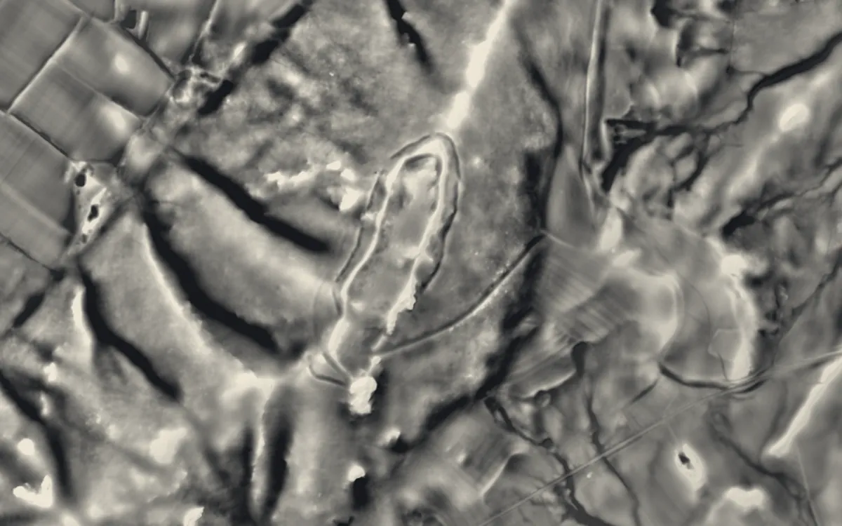
Places on the LiDAR in Shropshire
Each page shows the site on the LiDAR with its record, its location and the recorded places around it.
- Alberbury CastleCastle
- Bicton CastleMotte and bailey
- Boscobel HouseScheduled monument
- Bridgnorth CastleCastle
- Brogyntyn CastleMotte and bailey
- Bryn Amlwg CastleMotte and bailey
- Buildwas AbbeyAbbey
- Bury DitchesHillfort
- Bury WallsHillfort
- Caer CaradocHillfort
- Castle BankMotte and bailey
- Castle TootMotte and bailey
- Caus CastleHillfort
- Clun CastleMotte and bailey
- Coalport BridgeBridge
- Ellesmere CastleMotte and bailey
- Haughmond AbbeyAbbey
- Hay Inclined PlaneScheduled monument
- HoarstonesStone circle
- Holdgate CastleMotte and bailey
- Hopton CastleCastle
- Knockin CastleMotte and bailey
- Lilleshall AbbeyAbbey
- Longdon-Upon-Tern aqueductScheduled monument
- Ludlow CastleCastle
- Medieval Settlement, south-east of Upton Cressett HallDeserted village
- Moreton Corbet CastleCastle
- Multiple enclosure hillfort on Coxall KnollHillfort
- Nordy BankHillfort
- Old OswestryHillfort
- Oswestry CastleMotte and bailey
- Puleston CrossCross
- Ruyton CastleMotte and bailey
- Shrewsbury AbbeyAbbey
- Shrewsbury CastleCastle
- St James' Church, StirchleyChapel or church
- Stokesay CastleCastle
- The Iron BridgeBridge
- UxaconaScheduled monument
- Viroconium CornoviorumRoman site
- Wenlock PrioryPriory
- White Ladies PrioryPriory
- Whittington CastleCastle
LiDAR maps of the parishes of Shropshire
One page for each of the 230 parishes, with a LiDAR picture and the recorded places inside it.
- Abdon and Heath23 recorded places
- Acton Burnell12 recorded places
- Acton Round5 recorded places
- Acton Scott15 recorded places
- Adderley21 recorded places
- Alberbury with Cardeston43 recorded places
- Albrighton9 recorded places
- All Stretton6 recorded places
- Alveley22 recorded places
- Ashford Bowdler10 recorded places
- Ashford Carbonel16 recorded places
- Astley8 recorded places
- Astley Abbotts7 recorded places
- Aston Botterell6 recorded places
- Aston Eyre6 recorded places
- Atcham34 recorded places
- Badger7 recorded places
- Barrow16 recorded places
- Baschurch30 recorded places
- Bayston Hill10 recorded places
- Beckbury6 recorded places
- Bedstone4 recorded places
- Berrington29 recorded places
- Bettws-y-Crwyn9 recorded places
- Bicton25 recorded places
- Billingsley2 recorded places
- Bishop's Castle28 recorded places
- Bitterley33 recorded places
- Boningale6 recorded places
- Boraston4 recorded places
- Boscobel4 recorded places
- Bridgnorth72 recorded places
- Bromfield24 recorded places
- Broseley15 recorded places
- Bucknell8 recorded places
- Buildwas15 recorded places
- Burford11 recorded places
- Burwarton6 recorded places
- Cardington20 recorded places
- Caynham13 recorded places
- Chelmarsh6 recorded places
- Cheswardine20 recorded places
- Chetton13 recorded places
- Chetwynd30 recorded places
- Chetwynd Aston and Woodcote8 recorded places
- Child's Ercall8 recorded places
- Chirbury with Brompton67 recorded places
- Church Aston13 recorded places
- Church Preen5 recorded places
- Church Pulverbatch16 recorded places
- Church Stretton49 recorded places
- Claverley23 recorded places
- Clee St. Margaret7 recorded places
- Cleobury Mortimer25 recorded places
- Cleobury North6 recorded places
- Clive6 recorded places
- Clun87 recorded places
- Clunbury32 recorded places
- Clungunford11 recorded places
- Cockshutt11 recorded places
- Colebatch3 recorded places
- Condover44 recorded places
- Coreley13 recorded places
- Cound24 recorded places
- Craven Arms15 recorded places
- Cressage8 recorded places
- Culmington11 recorded places
- Dawley Hamlets18 recorded places
- Deuxhill3 recorded places
- Diddlebury29 recorded places
- Ditton Priors8 recorded places
- Donington14 recorded places
- Donnington and Muxton15 recorded places
- Eardington10 recorded places
- Easthope4 recorded places
- Eaton-under-Heywood12 recorded places
- Edgmond15 recorded places
- Edgton6 recorded places
- Ellesmere Rural39 recorded places
- Ellesmere Urban26 recorded places
- Ercall Magna28 recorded places
- Eyton Upon The Weald Moors4 recorded places
- Farlow8 recorded places
- Ford12 recorded places
- Frodesley4 recorded places
- Glazeley4 recorded places
- Great Dawley15 recorded places
- Great Hanwood11 recorded places
- Great Ness18 recorded places
- Greete11 recorded places
- Grinshill11 recorded places
- Hadley & Leegomery14 recorded places
- Hadnall7 recorded places
- Harley9 recorded places
- Highley11 recorded places
- Hinstock11 recorded places
- Hodnet27 recorded places
- Hollinswood and Randlay3 recorded places
- Hope Bagot8 recorded places
- Hope Bowdler11 recorded places
- Hopesay19 recorded places
- Hopton Cangeford5 recorded places
- Hopton Castle9 recorded places
- Hopton Wafers17 recorded places
- Hordley11 recorded places
- Hughley3 recorded places
- Ightfield13 recorded places
- Kemberton6 recorded places
- Kenley4 recorded places
- Ketley8 recorded places
- Kinlet16 recorded places
- Kinnerley19 recorded places
- Knockin6 recorded places
- Kynnersley3 recorded places
- Lawley and Overdale14 recorded places
- Leebotwood7 recorded places
- Leighton and Eaton Constantine26 recorded places
- Lilleshall13 recorded places
- Little Ness5 recorded places
- Little Wenlock10 recorded places
- Llanfair Waterdine23 recorded places
- Llanyblodwel36 recorded places
- Llanymynech and Pant19 recorded places
- Longden11 recorded places
- Longnor9 recorded places
- Loppington7 recorded places
- Ludford9 recorded places
- Ludlow80 recorded places
- Lydbury North26 recorded places
- Lydham20 recorded places
- Madeley33 recorded places
- Mainstone14 recorded places
- Market Drayton37 recorded places
- Melverley4 recorded places
- Middleton Scriven3 recorded places
- Milson4 recorded places
- Minsterley16 recorded places
- Monkhopton4 recorded places
- Montford15 recorded places
- More16 recorded places
- Moreton Corbet and Lee Brockhurst30 recorded places
- Moreton Say14 recorded places
- Morville10 recorded places
- Much Wenlock28 recorded places
- Munslow22 recorded places
- Myddle, Broughton and Harmer Hill16 recorded places
- Myndtown9 recorded places
- Nash6 recorded places
- Neen Savage12 recorded places
- Neen Sollars11 recorded places
- Neenton7 recorded places
- Newcastle on Clun18 recorded places
- Newport20 recorded places
- Norbury6 recorded places
- Norton in Hales15 recorded places
- Oakengates9 recorded places
- Onibury9 recorded places
- Oswestry49 recorded places
- Oswestry Rural65 recorded places
- Petton4 recorded places
- Pimhill45 recorded places
- Pitchford11 recorded places
- Pontesbury42 recorded places
- Prees17 recorded places
- Preston Upon The Weald Moors7 recorded places
- Quatt Malvern5 recorded places
- Ratlinghope20 recorded places
- Richard's Castle (Shropshire)10 recorded places
- Rodington15 recorded places
- Romsley3 recorded places
- Ruckley and Langley6 recorded places
- Rudge4 recorded places
- Rushbury15 recorded places
- Ruyton-XI-Towns16 recorded places
- Ryton5 recorded places
- Selattyn and Gobowen33 recorded places
- Shawbury20 recorded places
- Sheinton5 recorded places
- Sheriffhales20 recorded places
- Shifnal34 recorded places
- Shipton7 recorded places
- Shrewsbury231 recorded places
- Sibdon Carwood5 recorded places
- Sidbury5 recorded places
- Smethcott9 recorded places
- St Georges and Priorslee10 recorded places
- St. Martin's11 recorded places
- Stanton Lacy9 recorded places
- Stanton Long8 recorded places
- Stanton upon Hine Heath13 recorded places
- Stirchley and Brookside2 recorded places
- Stockton13 recorded places
- Stoke St. Milborough8 recorded places
- Stoke upon Tern23 recorded places
- Stottesdon13 recorded places
- Stowe5 recorded places
- Sutton Maddock5 recorded places
- Sutton upon Tern18 recorded places
- Tasley3 recorded places
- The Gorge58 recorded places
- Tibberton and Cherrington7 recorded places
- Tong12 recorded places
- Uffington16 recorded places
- Upton Cressett7 recorded places
- Upton Magna21 recorded places
- Waters Upton15 recorded places
- Wellington22 recorded places
- Welshampton and Lyneal30 recorded places
- Wem Rural34 recorded places
- Wem Urban20 recorded places
- Wentnor7 recorded places
- West Felton27 recorded places
- Westbury27 recorded places
- Weston Rhyn28 recorded places
- Weston-under-Redcastle19 recorded places
- Wheathill9 recorded places
- Whitchurch Rural15 recorded places
- Whitchurch Urban36 recorded places
- Whittington21 recorded places
- Whitton3 recorded places
- Whixall17 recorded places
- Wistanstow33 recorded places
- Withington4 recorded places
- Woolstaston4 recorded places
- Woore15 recorded places
- Worfield29 recorded places
- Worthen with Shelve57 recorded places
- Wrockwardine32 recorded places
- Wrockwardine Wood and Trench8 recorded places
- Wroxeter and Uppington45 recorded places
About the LiDAR
The terrain model is made from an airborne laser survey with vegetation and buildings removed, so earthworks show as height: hillfort ramparts, barrows, Roman road banks, hollow ways and ridge and furrow. In the app the picture is computed as you change the settings, with a moveable sun, a local relief model, multidirectional hillshading and the VAT composite. See how to read a LiDAR map and what archaeology looks like on LiDAR.
Sources
- LiDAR: Environment Agency, 1 m composite DTM, Open Government Licence.
- Recorded places: the national heritage records (Historic England, Cadw, Coflein and others) as held by Waystone.
Last updated 2026-10-16.