Home LiDAR map Wales Pembrokeshire
LiDAR map of Pembrokeshire
Waystone shows the bare-earth LiDAR of Pembrokeshire at one metre per pixel, with the 3,398 recorded historic places the heritage records hold here, the Roman roads and the Ordnance Survey six-inch maps of 1843–1913 over the same ground. Free, in a browser.
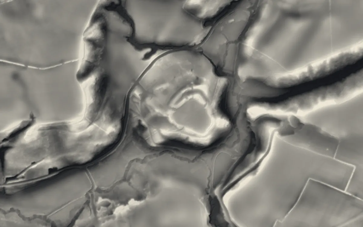
Places on the LiDAR in Pembrokeshire
Each page shows the site on the LiDAR with its record, its location and the recorded places around it.
- Bedd ArthurEarthwork
- Carew BridgeBridge
- Carew CastleCastle
- Carew CrossCross
- Carreg SamsonBarrow
- Carswell Medieval HouseScheduled monument
- Castell HenllysHillfort
- Castle FlemishRoman site
- Chapel Bay FortMilitary site
- Cilgerran CastleCastle
- Clegyr BoiaHillfort
- Coetan ArthurBarrow
- Cresswell CastleCastle
- Foel DrygarnHillfort
- Fort HubberstoneMilitary site
- Haverfordwest CastleCastle
- Haverfordwest PrioryPriory
- King's QuoitScheduled monument
- Lamphey Bishop's PalaceScheduled monument
- Limekilns at Kiln Park, PembrokeshireScheduled monument
- Llawhaden BridgeBridge
- Llawhaden CastleCastle
- Lydstep PalaceScheduled monument
- Manorbier CastleCastle
- Manorbier DovecoteScheduled monument
- Narberth CastleCastle
- Nevern High CrossCross
- Paterchurch TowerScheduled monument
- Pembroke CastleCastle
- Pembroke Town WallsScheduled monument
- Pill PrioryPriory
- Ruins of St. Justinian's Chapel, PorthstinianChapel or church
- Scoveston FortMilitary site
- Solva limekilnsIndustrial site
- South Hook FortMilitary site
- St Davids Bishop's PalaceScheduled monument
- St Dogmaels AbbeyAbbey
- St Non's ChapelChapel or church
- Tenby CastleCastle
- Tenby Town WallsScheduled monument
- The Defensible Barracks Presely View (w End)Scheduled monument
- Waun Mawn Standing StoneStone circle
- West Blockhouse FortMilitary site
- West Tarr Mediaeval HouseScheduled monument
- WhitewellScheduled monument
- Wiston CastleMotte and bailey
LiDAR maps of the communities of Pembrokeshire
One page for each of the 77 communities, with a LiDAR picture and the recorded places inside it.
- Ambleston18 recorded places
- Amroth52 recorded places
- Angle94 recorded places
- Boncath27 recorded places
- Brawdy49 recorded places
- Burton29 recorded places
- Camrose45 recorded places
- Carew61 recorded places
- Cilgerran40 recorded places
- Clydau32 recorded places
- Clynderwen37 recorded places
- Cosheston30 recorded places
- Crymych50 recorded places
- Cwm Gwaun56 recorded places
- Dale44 recorded places
- Dinas Cross40 recorded places
- East Williamston11 recorded places
- Eglwyswrw73 recorded places
- Fishguard and Goodwick59 recorded places
- Freystrop12 recorded places
- Haverfordwest80 recorded places
- Hayscastle26 recorded places
- Herbrandston13 recorded places
- Hook5 recorded places
- Hundleton31 recorded places
- Jeffreyston36 recorded places
- Johnston7 recorded places
- Kilgetty/Begelly48 recorded places
- Lampeter Velfrey46 recorded places
- Lamphey26 recorded places
- Letterston15 recorded places
- Llanddewi Velfrey25 recorded places
- Llandissilio West12 recorded places
- Llangwm9 recorded places
- Llanrhian66 recorded places
- Llanstadwell24 recorded places
- Llawhaden52 recorded places
- Maenclochog48 recorded places
- Manorbier61 recorded places
- Manordeifi36 recorded places
- Marloes and St. Brides53 recorded places
- Martletwy55 recorded places
- Mathry40 recorded places
- Merlin's Bridge14 recorded places
- Milford Haven86 recorded places
- Mynachlog-Ddu44 recorded places
- Narberth35 recorded places
- Nevern91 recorded places
- New Moat29 recorded places
- Newport57 recorded places
- Neyland22 recorded places
- Nolton and Roch31 recorded places
- Pembroke60 recorded places
- Pembroke Dock76 recorded places
- Penally27 recorded places
- Pencaer81 recorded places
- Puncheston75 recorded places
- Rosemarket9 recorded places
- Rudbaxton32 recorded places
- Saundersfoot39 recorded places
- Scleddau51 recorded places
- Solva42 recorded places
- Spittal11 recorded places
- St. David's and the Cathedral Close120 recorded places
- St. Dogmaels41 recorded places
- St. Florence19 recorded places
- St. Ishmael's52 recorded places
- St. Mary Out Liberty13 recorded places
- Stackpole and Castlemartin147 recorded places
- Templeton19 recorded places
- Tenby98 recorded places
- The Havens52 recorded places
- Tiers Cross19 recorded places
- Uzmaston, Boulston and Slebech50 recorded places
- Walwyn's Castle23 recorded places
- Wiston64 recorded places
- Wolfscastle40 recorded places
About the LiDAR
The terrain model is made from an airborne laser survey with vegetation and buildings removed, so earthworks show as height: hillfort ramparts, barrows, Roman road banks, hollow ways and ridge and furrow. In the app the picture is computed as you change the settings, with a moveable sun, a local relief model, multidirectional hillshading and the VAT composite. See how to read a LiDAR map and what archaeology looks like on LiDAR.
Sources
- LiDAR: Natural Resources Wales and Welsh Government, 1 m DTM, Open Government Licence.
- Recorded places: the national heritage records (Historic England, Cadw, Coflein and others) as held by Waystone.
Last updated 2026-10-16.