Home Monument types Ridge and furrow
What is ridge and furrow?
Ridge and furrow is a pattern of long, parallel ridges separated by furrows, formed by ploughing strips of land in the same way year after year. It is the surviving earthwork of open-field farming, characteristic of the medieval period.
- Period
- Medieval and post-medieval; narrow, straight ridging is later, in places 19th century.
- Also called
- rig and furrow, open-field strips, broad rig, narrow rig
- Pages on Waystone
- 2 in England and Wales
What ridge and furrow is
Each ridge was built up as the plough turned the soil towards the centre of the strip; surviving ridges are usually 3 to 20 metres apart and up to about 60 centimetres high. Ridges were grouped into blocks called furlongs, and the plough was turned on unploughed headlands at the ends, which survive as low banks across the ends of the ridges. Medieval ridges often curve in a reversed S-shape, caused by the plough team turning at the end of each strip, while later narrow ridges, about 4 metres apart, are ruler-straight and in places are thought to come from 19th-century steam ploughing. The best-preserved areas are in the English Midlands, often on land turned over to pasture and not ploughed again.
How ridge and furrow looks on LiDAR
Ridge and furrow is very common on terrain models of the English Midlands, where it shows as fields of evenly spaced parallel ridges, grouped in blocks running in different directions and often crossing modern field boundaries. A local relief model shows it best because the ridges are low and the model removes the general slope, while hillshade shows it well only when the light falls across the ridges rather than along them. The headlands, the reversed-S curve and the way blocks meet help to separate medieval ridge and furrow from later straight ridging.
See LiDAR visualisations explained for what each method shows.
What can look like one
Straight, narrow ridging from 19th-century steam ploughing, water-meadow bedworks on valley floors, modern field drains, spade-dug cultivation ridges in the uplands and forestry ploughing can all look like ridge and furrow. Forestry ploughing furrows are usually much closer together and very straight.
Protection
Ridge and furrow is rarely scheduled on its own; some areas are protected as part of scheduled deserted villages, and most survives without statutory protection.
Examples on the LiDAR
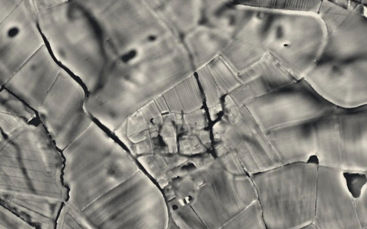 Medieval settlement, including site of chapel and part of the open field system, immediately north east of Alkmonton Old Hall FaDerbyshire
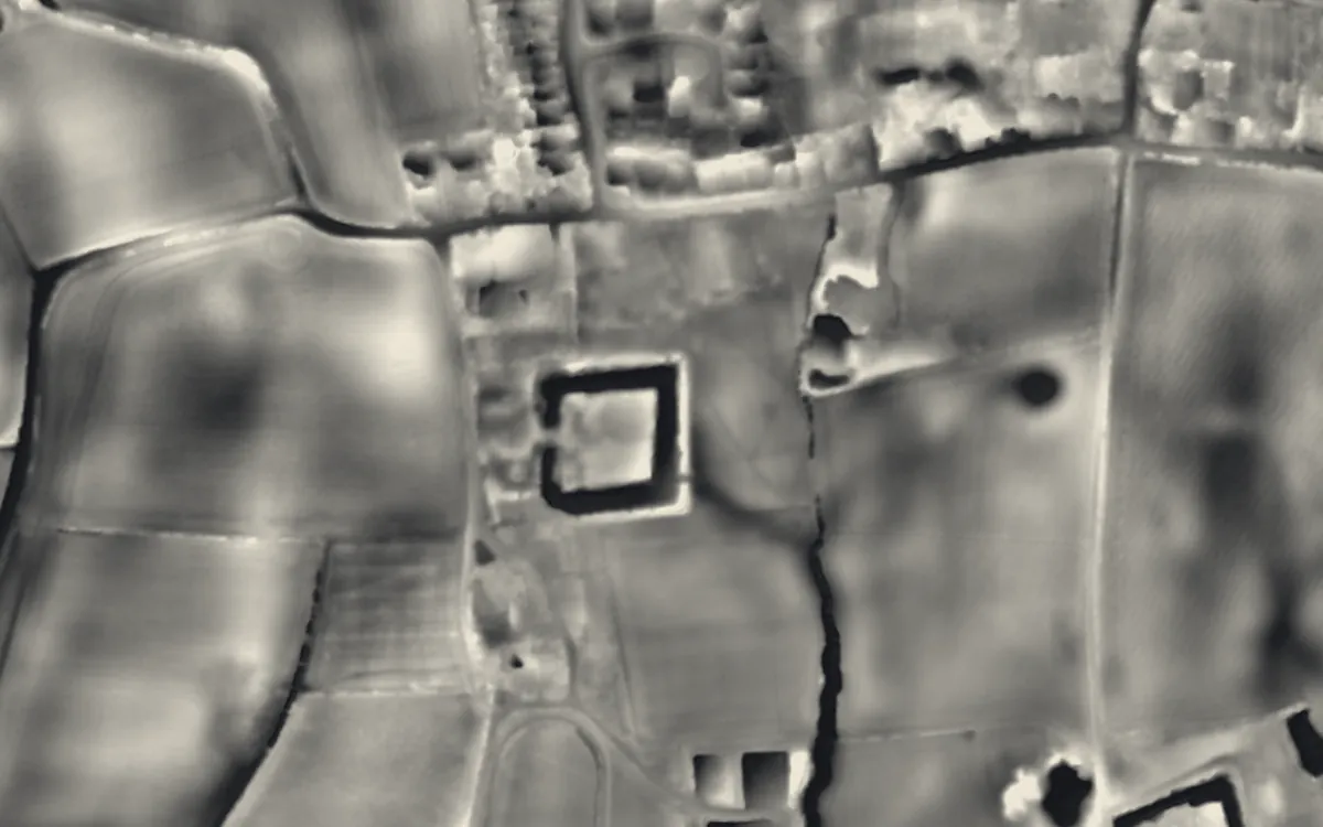 Rock Farm moated site, deserted medieval village and ridge and furrow, 100m SE of St Peter and St Paul's ChurchWorcestershire
Where they are
Counties with the most ridge and furrow that have a page here.
- Derbyshire1 with a page
- Worcestershire1 with a page
Sources
- FISH Thesaurus of Monument Types (Historic England): Ridge And Furrow
- FISH Thesaurus of Monument Types (Historic England): Broad Ridge And Furrow
- FISH Thesaurus of Monument Types (Historic England): Narrow Ridge And Furrow
- Monument Type Thesaurus (Wales), RCAHMW: Ridge and Furrow
- Buckinghamshire's Heritage Portal (HER): Great Horwood open fields, 0934200001
- Dorset Heritage Explorer (HER): Post medieval cultivation marks, Moonhay, Whitchurch Canonicorum, MDO38786
- Wikipedia: Ridge and furrow (cross-check)
- Relief Visualization Toolbox documentation: Simple local relief model
- Relief Visualization Toolbox documentation: Hillshading
Last updated 2026-10-16.