Home Monument types Field system
What is a field system?
A field system is a group of fields that appear to form a coherent whole, defined by banks, walls, ditches, lynchets or the edges of cultivation. Archaeologists use the term mainly for fields that have gone out of use and survive as earthworks or cropmarks.
- Period
- Bronze Age to post-medieval; prehistoric and Roman field systems date from about 2000 BC to the 5th century AD.
- Also called
- Celtic fields, coaxial field system, regular aggregate field system, irregular aggregate field system, prehistoric fields
- Pages on Waystone
- 4 in England and Wales
What a field system is
Prehistoric and Roman field systems are classed by layout: coaxial systems have one main axis, with most boundaries parallel to it or at right angles, while aggregate systems developed piecemeal and may be regular or irregular. Historic England's scheduling texts date regular aggregate field systems from the Bronze Age (about 2000 to 700 BC) to the end of the 5th century AD, and their small, roughly rectangular plots are often called 'Celtic' fields, a term with no cultural meaning. Medieval and later field systems include open fields of ridge and furrow, strip lynchets and the enclosed fields of later centuries. In the uplands, prehistoric fields are often marked by stone banks and clearance cairns.
How field systems look on LiDAR
Field systems show as networks of low banks, scarps and lynchets dividing the ground into plots, usually running across modern field boundaries. A local relief model shows the full layout best because the banks are low and extensive, and hillshade from several directions helps on slopes, where lynchets show as steps. Positive openness emphasises the lines of banks and walls, and sky-view factor shows ditched boundaries.
See LiDAR visualisations explained for what each method shows.
What can look like one
Removed modern and post-medieval field boundaries, natural geological banding, slope terraces and drainage patterns can look like ancient fields. Prehistoric systems usually ignore the present field pattern, while removed modern boundaries match the lines on old Ordnance Survey maps.
Protection
Some well-preserved prehistoric and Roman field systems are scheduled monuments, protected in England by the Ancient Monuments and Archaeological Areas Act 1979 and in Wales by the Historic Environment (Wales) Act 2023.
Examples on the LiDAR
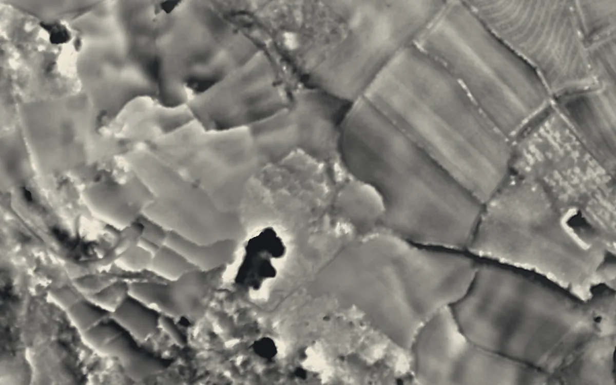 Round, courtyard house, stone hut circle settlement and field system 275m north of Castallack CarnCornwall
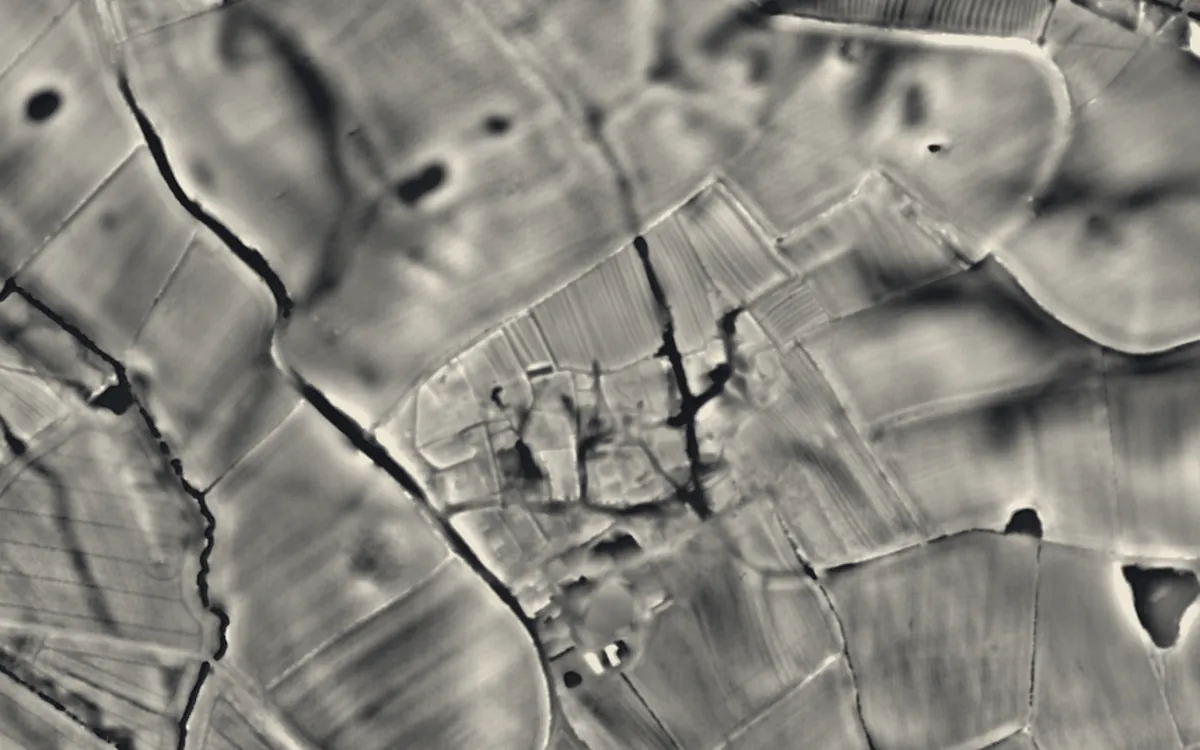 Medieval settlement, including site of chapel and part of the open field system, immediately north east of Alkmonton Old Hall FaDerbyshire
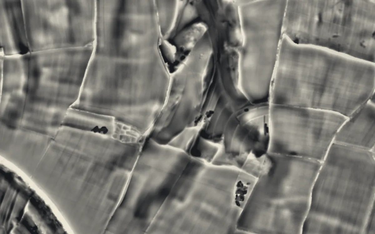 Iron Age settlement and associated field system on Smedmore HillDorset
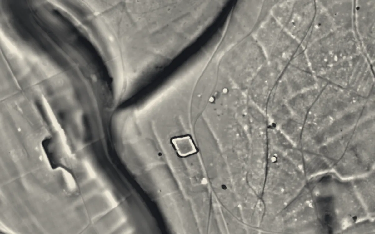 South Lodge camp Bronze Age enclosure with associated field system and round barrow cemetery, 350m east of Rushmore FarmWiltshire
Where they are
Counties with the most field systems that have a page here.
- Cornwall1 with a page
- Derbyshire1 with a page
- Dorset1 with a page
- Wiltshire1 with a page
Sources
- FISH Thesaurus of Monument Types (Historic England): Field System
- FISH Thesaurus of Monument Types (Historic England): Coaxial Field System
- FISH Thesaurus of Monument Types (Historic England): Irregular/Regular Aggregate Field System
- FISH Thesaurus of Monument Types (Historic England): Celtic Field System
- Monument Type Thesaurus (Wales), RCAHMW: Field System
- Historic England, Introductions to Heritage Assets: Field Systems
- Historic England, National Heritage List entry 1019121: Bell barrow, bowl barrow and regular aggregate field system immediately east of Ganderdown Farm
- Historic England, National Heritage List entry 1008861: Field system including over 300 clearance cairns and two hut circles at Iron Howe
- Wikipedia: Celtic field (cross-check)
- Relief Visualization Toolbox documentation: Simple local relief model
Last updated 2026-10-16.