LiDAR map of Swansea
Waystone shows the bare-earth LiDAR of Swansea at one metre per pixel, with the 1,470 recorded historic places the heritage records hold here, the Roman roads and the Ordnance Survey six-inch maps of 1843–1913 over the same ground. Free, in a browser.
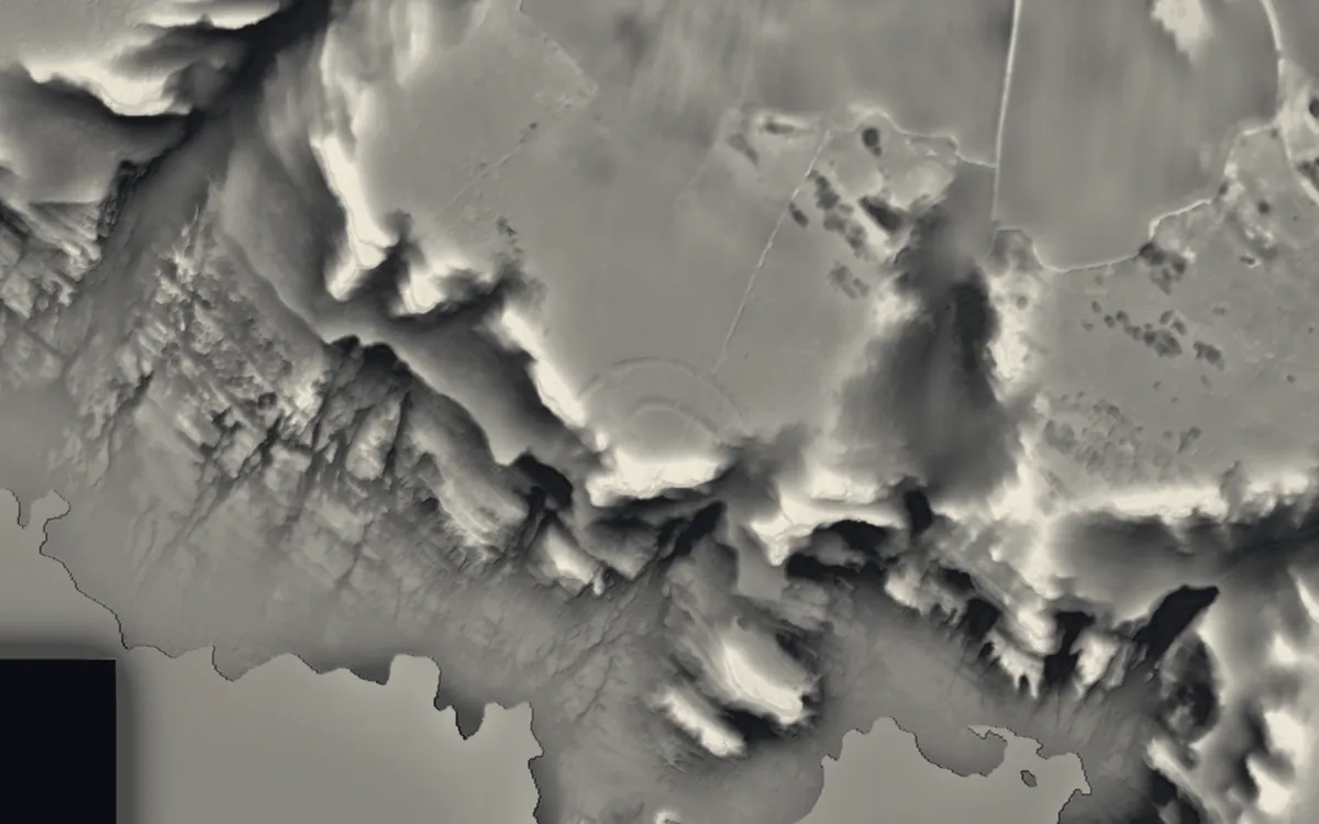
Places on the LiDAR in Swansea
Each page shows the site on the LiDAR with its record, its location and the recorded places around it.
- Deborah's Hole CampHillfort
- Loughor CastleCastle
- Morris CastleScheduled monument
- Oxwich CastleFortified manor house
- Oystermouth CastleCastle
- Parc le Breos Chambered TombBarrow
- Penlle'r CastellCastle
- Pennard CastleMotte and bailey
- Penrice CastleCastle
- Swansea CastleCastle
- Weobley CastleCastle
LiDAR maps of the communities of Swansea
One page for each of the 41 communities, with a LiDAR picture and the recorded places inside it.
- Birchgrove19 recorded places
- Bishopston19 recorded places
- Bonymaen53 recorded places
- Castle87 recorded places
- Clydach41 recorded places
- Cockett17 recorded places
- Cwmbwrla22 recorded places
- Dunvant7 recorded places
- Gorseinon31 recorded places
- Gowerton25 recorded places
- Grovesend and Waungron16 recorded places
- Ilston49 recorded places
- Killay9 recorded places
- Landore65 recorded places
- Llangennith, Llanmadoc and Cheriton78 recorded places
- Llangyfelach16 recorded places
- Llanrhidian Higher36 recorded places
- Llanrhidian Lower57 recorded places
- Llansamlet42 recorded places
- Llwchwr42 recorded places
- Mawr81 recorded places
- Morriston52 recorded places
- Mumbles98 recorded places
- Mynyddbach25 recorded places
- Penderry9 recorded places
- Penllergaer15 recorded places
- Pennard36 recorded places
- Penrice23 recorded places
- Pontarddulais69 recorded places
- Pontlliw and Tircoed10 recorded places
- Port Eynon29 recorded places
- Reynoldston16 recorded places
- Rhossili42 recorded places
- Sketty39 recorded places
- St Thomas24 recorded places
- Three Crosses4 recorded places
- Townhill16 recorded places
- Uplands40 recorded places
- Upper Killay9 recorded places
- Waterfront66 recorded places
- Waunarlwydd9 recorded places
About the LiDAR
The terrain model is made from an airborne laser survey with vegetation and buildings removed, so earthworks show as height: hillfort ramparts, barrows, Roman road banks, hollow ways and ridge and furrow. In the app the picture is computed as you change the settings, with a moveable sun, a local relief model, multidirectional hillshading and the VAT composite. See how to read a LiDAR map and what archaeology looks like on LiDAR.
Sources
- LiDAR: Natural Resources Wales and Welsh Government, 1 m DTM, Open Government Licence.
- Recorded places: the national heritage records (Historic England, Cadw, Coflein and others) as held by Waystone.
Last updated 2026-10-16.