Home LiDAR map England Suffolk
LiDAR map of Suffolk
Waystone shows the bare-earth LiDAR of Suffolk at one metre per pixel, with the 8,198 recorded historic places the heritage records hold here, the Roman roads and the Ordnance Survey six-inch maps of 1843–1913 over the same ground. Free, in a browser.
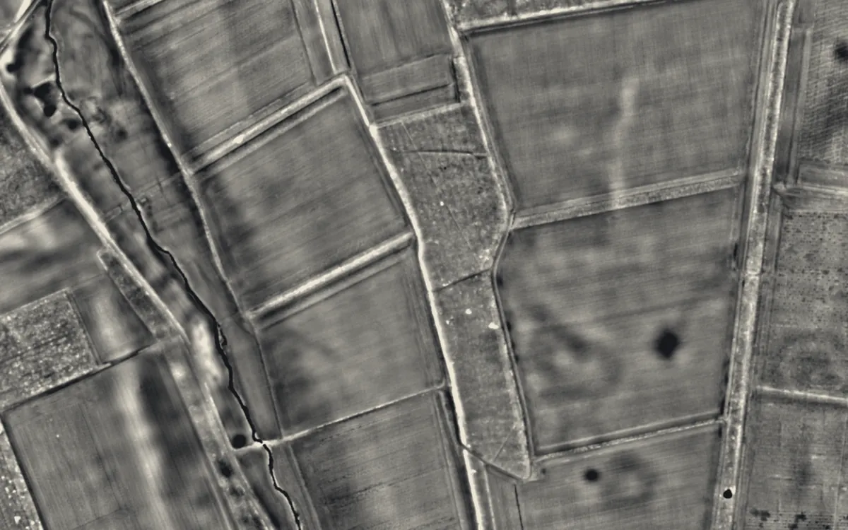
Places on the LiDAR in Suffolk
Each page shows the site on the LiDAR with its record, its location and the recorded places around it.
- Black Ditches, CavenhamScheduled monument
- Blythburgh PrioryPriory
- Bungay CastleCastle
- Campsey PrioryPriory
- Clare CastleCastle
- Clare PrioryPriory
- Eye CastleMotte and bailey
- Eye PrioryPriory
- Gateway to Wolsey's College of St MaryScheduled monument
- Great Ashfield CastleMotte and bailey
- Greyfriars, DunwichScheduled monument
- Haughley CastleCastle
- Hoxne PrioryPriory
- Interrupted ditch system at Potash FarmScheduled monument
- Ipswich BlackfriarsChapel or church
- Kersey PrioryPriory
- Lady Alice KenlisScheduled monument
- Landguard FortCastle
- Letheringham PrioryPriory
- Lidgate CastleCastle
- Little Wenham HallScheduled monument
- Mendham PrioryPriory
- Mettingham CastleCastle
- Milden CastleCastle
- Saxtead Green WindmillIndustrial site
- Shotley BatteryMilitary site
- Sibton AbbeyAbbey
- St James' Chapel, LindseyChapel or church
- Sutton HooScheduled monument
- Upthorpe MillIndustrial site
- Walton PrioryPriory
LiDAR maps of the parishes of Suffolk
One page for each of the 480 parishes, with a LiDAR picture and the recorded places inside it.
- Acton10 recorded places
- Akenham2 recorded places
- Aldeburgh152 recorded places
- Alderton59 recorded places
- Aldham5 recorded places
- Aldringham cum Thorpe58 recorded places
- All Saints and St. Nicholas, South Elmham9 recorded places
- Alpheton7 recorded places
- Ampton4 recorded places
- Arwarton31 recorded places
- Ashbocking5 recorded places
- Ashfield cum Thorpe5 recorded places
- Aspall3 recorded places
- Assington7 recorded places
- Athelington2 recorded places
- Bacton12 recorded places
- Badingham7 recorded places
- Badley7 recorded places
- Badwell Ash8 recorded places
- Bardwell15 recorded places
- Barham14 recorded places
- Barking12 recorded places
- Barnardiston2 recorded places
- Barnby9 recorded places
- Barnham34 recorded places
- Barningham9 recorded places
- Barrow7 recorded places
- Barsham15 recorded places
- Barton Mills18 recorded places
- Battisford4 recorded places
- Bawdsey163 recorded places
- Baylham15 recorded places
- Beccles41 recorded places
- Beck Row, Holywell Row and Kenny Hill8 recorded places
- Bedfield6 recorded places
- Bedingfield8 recorded places
- Belstead11 recorded places
- Benacre45 recorded places
- Benhall9 recorded places
- Bentley12 recorded places
- Beyton6 recorded places
- Bildeston17 recorded places
- Blaxhall8 recorded places
- Blundeston34 recorded places
- Blyford4 recorded places
- Blythburgh31 recorded places
- Botesdale12 recorded places
- Boulge6 recorded places
- Boxford16 recorded places
- Boxted7 recorded places
- Boyton44 recorded places
- Bradfield Combust with Stanningfield14 recorded places
- Bradfield St. Clare2 recorded places
- Bradfield St. George3 recorded places
- Braiseworth5 recorded places
- Bramfield10 recorded places
- Bramford17 recorded places
- Brampton with Stoven13 recorded places
- Brandeston8 recorded places
- Brandon76 recorded places
- Brantham19 recorded places
- Bredfield9 recorded places
- Brent Eleigh8 recorded places
- Brettenham5 recorded places
- Brightwell8 recorded places
- Brockley4 recorded places
- Brome and Oakley12 recorded places
- Bromeswell14 recorded places
- Bruisyard4 recorded places
- Brundish5 recorded places
- Bucklesham16 recorded places
- Bungay38 recorded places
- Bures St. Mary17 recorded places
- Burgate7 recorded places
- Burgh9 recorded places
- Burstall3 recorded places
- Bury St Edmunds229 recorded places
- Butley32 recorded places
- Buxhall8 recorded places
- Campsey Ash9 recorded places
- Capel St. Andrew21 recorded places
- Capel St. Mary8 recorded places
- Carlton Colville27 recorded places
- Cavendish18 recorded places
- Cavenham15 recorded places
- Charsfield5 recorded places
- Chattisham2 recorded places
- Chedburgh4 recorded places
- Chediston7 recorded places
- Chelmondiston14 recorded places
- Chelsworth7 recorded places
- Chevington8 recorded places
- Chillesford13 recorded places
- Chilton5 recorded places
- Clare41 recorded places
- Claydon13 recorded places
- Clopton2 recorded places
- Cockfield22 recorded places
- Coddenham22 recorded places
- Combs12 recorded places
- Coney Weston8 recorded places
- Cookley3 recorded places
- Copdock and Washbrook9 recorded places
- Corton40 recorded places
- Cotton5 recorded places
- Covehithe32 recorded places
- Cowlinge9 recorded places
- Cransford5 recorded places
- Cratfield3 recorded places
- Creeting St. Mary22 recorded places
- Creeting St. Peter or West Creeting9 recorded places
- Cretingham5 recorded places
- Crowfield5 recorded places
- Culford24 recorded places
- Culpho5 recorded places
- Dalham8 recorded places
- Dallinghoo6 recorded places
- Darmsden4 recorded places
- Darsham7 recorded places
- Debach2 recorded places
- Debenham28 recorded places
- Denham6 recorded places
- Denham5 recorded places
- Dennington11 recorded places
- Denston7 recorded places
- Depden7 recorded places
- Drinkstone7 recorded places
- Dunwich55 recorded places
- Earl Soham9 recorded places
- Earl Stonham7 recorded places
- East Bergholt27 recorded places
- Easton10 recorded places
- Edwardstone11 recorded places
- Ellough4 recorded places
- Elmsett7 recorded places
- Elmswell9 recorded places
- Elveden48 recorded places
- Eriswell19 recorded places
- Euston23 recorded places
- Exning22 recorded places
- Eye35 recorded places
- Eyke19 recorded places
- Fakenham Magna12 recorded places
- Falkenham11 recorded places
- Farnham6 recorded places
- Felixstowe173 recorded places
- Felsham5 recorded places
- Finningham8 recorded places
- Flempton14 recorded places
- Flixton (Bungay & Wainford Ward)23 recorded places
- Flixton (Lothingland Ward)8 recorded places
- Flowton3 recorded places
- Fornham All Saints12 recorded places
- Fornham St. Genevieve4 recorded places
- Fornham St. Martin6 recorded places
- Foxhall12 recorded places
- Framlingham41 recorded places
- Framsden16 recorded places
- Freckenham7 recorded places
- Fressingfield17 recorded places
- Freston20 recorded places
- Friston30 recorded places
- Frostenden14 recorded places
- Gazeley8 recorded places
- Gedding4 recorded places
- Gedgrave29 recorded places
- Gipping5 recorded places
- Gisleham27 recorded places
- Gislingham9 recorded places
- Glemsford15 recorded places
- Gosbeck3 recorded places
- Great Ashfield9 recorded places
- Great Barton7 recorded places
- Great Bealings13 recorded places
- Great Blakenham13 recorded places
- Great Bradley3 recorded places
- Great Bricett5 recorded places
- Great Cornard11 recorded places
- Great Finborough8 recorded places
- Great Glemham9 recorded places
- Great Livermere7 recorded places
- Great Thurlow11 recorded places
- Great Waldingfield10 recorded places
- Great Whelnetham11 recorded places
- Great Wratting6 recorded places
- Groton11 recorded places
- Grundisburgh4 recorded places
- Hacheston13 recorded places
- Hadleigh86 recorded places
- Halesworth25 recorded places
- Hargrave4 recorded places
- Harkstead33 recorded places
- Harleston3 recorded places
- Hartest5 recorded places
- Hasketon10 recorded places
- Haughley19 recorded places
- Haverhill21 recorded places
- Hawkedon12 recorded places
- Hawstead7 recorded places
- Helmingham12 recorded places
- Hemingstone5 recorded places
- Hemley15 recorded places
- Hengrave9 recorded places
- Henley4 recorded places
- Henstead with Hulver Street20 recorded places
- Hepworth7 recorded places
- Herringswell6 recorded places
- Hessett9 recorded places
- Heveningham12 recorded places
- Higham5 recorded places
- Higham7 recorded places
- Hinderclay4 recorded places
- Hintlesham9 recorded places
- Hitcham10 recorded places
- Holbrook44 recorded places
- Hollesley85 recorded places
- Holton13 recorded places
- Holton St. Mary6 recorded places
- Honington6 recorded places
- Hoo8 recorded places
- Hopton9 recorded places
- Horham5 recorded places
- Horringer12 recorded places
- Hoxne21 recorded places
- Hundon14 recorded places
- Hunston2 recorded places
- Huntingfield8 recorded places
- Icklingham32 recorded places
- Ickworth7 recorded places
- Iken39 recorded places
- Ingham6 recorded places
- Ipswich260 recorded places
- Ixworth20 recorded places
- Ixworth Thorpe4 recorded places
- Kedington12 recorded places
- Kelsale cum Carlton14 recorded places
- Kentford2 recorded places
- Kenton4 recorded places
- Kersey27 recorded places
- Kesgrave15 recorded places
- Kessingland62 recorded places
- Kettlebaston4 recorded places
- Kettleburgh5 recorded places
- Kirton25 recorded places
- Knettishall6 recorded places
- Knodishall7 recorded places
- Lackford21 recorded places
- Lakenheath17 recorded places
- Langham5 recorded places
- Lavenham60 recorded places
- Lawshall15 recorded places
- Laxfield16 recorded places
- Layham11 recorded places
- Leavenheath4 recorded places
- Leiston81 recorded places
- Letheringham5 recorded places
- Levington29 recorded places
- Lidgate9 recorded places
- Lindsey7 recorded places
- Linstead Magna2 recorded places
- Linstead Parva3 recorded places
- Little Bealings7 recorded places
- Little Blakenham7 recorded places
- Little Bradley4 recorded places
- Little Cornard8 recorded places
- Little Finborough2 recorded places
- Little Glemham10 recorded places
- Little Livermere4 recorded places
- Little Thurlow11 recorded places
- Little Waldingfield6 recorded places
- Little Whelnetham5 recorded places
- Little Wratting2 recorded places
- Long Melford69 recorded places
- Lound21 recorded places
- Lowestoft241 recorded places
- Market Weston5 recorded places
- Marlesford7 recorded places
- Martlesham52 recorded places
- Mellis8 recorded places
- Melton28 recorded places
- Mendham17 recorded places
- Mendlesham10 recorded places
- Metfield5 recorded places
- Mettingham10 recorded places
- Mickfield5 recorded places
- Middleton7 recorded places
- Milden6 recorded places
- Mildenhall High17 recorded places
- Monewden4 recorded places
- Monk Soham3 recorded places
- Monks Eleigh17 recorded places
- Moulton9 recorded places
- Mutford10 recorded places
- Nacton43 recorded places
- Nayland-with-Wissington34 recorded places
- Nedging-with-Naughton10 recorded places
- Needham Market37 recorded places
- Nettlestead7 recorded places
- Newbourne9 recorded places
- Newmarket44 recorded places
- Newton7 recorded places
- North Cove12 recorded places
- Norton14 recorded places
- Nowton7 recorded places
- Occold6 recorded places
- Offton6 recorded places
- Old Newton with Dagworth10 recorded places
- Onehouse10 recorded places
- Orford57 recorded places
- Otley13 recorded places
- Oulton16 recorded places
- Oulton Broad29 recorded places
- Ousden7 recorded places
- Pakenham20 recorded places
- Palgrave10 recorded places
- Parham7 recorded places
- Peasenhall9 recorded places
- Pettaugh3 recorded places
- Pettistree9 recorded places
- Pinewood10 recorded places
- Playford4 recorded places
- Polstead14 recorded places
- Poslingford6 recorded places
- Preston St. Mary8 recorded places
- Purdis Farm3 recorded places
- Ramsholt22 recorded places
- Rattlesden13 recorded places
- Raydon9 recorded places
- Red Lodge3 recorded places
- Rede4 recorded places
- Redgrave12 recorded places
- Redisham2 recorded places
- Redlingfield6 recorded places
- Rendham5 recorded places
- Rendlesham20 recorded places
- Reydon49 recorded places
- Rickinghall Inferior11 recorded places
- Rickinghall Superior13 recorded places
- Ringsfield5 recorded places
- Ringshall7 recorded places
- Risby6 recorded places
- Rishangles7 recorded places
- Rumburgh3 recorded places
- Rushbrooke with Rougham17 recorded places
- Rushmere10 recorded places
- Rushmere St. Andrew11 recorded places
- Santon Downham86 recorded places
- Sapiston5 recorded places
- Saxmundham16 recorded places
- Saxtead7 recorded places
- Semer7 recorded places
- Shadingfield7 recorded places
- Shelland2 recorded places
- Shelley5 recorded places
- Shimpling13 recorded places
- Shipmeadow4 recorded places
- Shotley75 recorded places
- Shottisham28 recorded places
- Sibton12 recorded places
- Snape22 recorded places
- Somerleyton, Ashby and Herringfleet51 recorded places
- Somersham2 recorded places
- Somerton4 recorded places
- Sotherton7 recorded places
- Sotterley7 recorded places
- South Cove20 recorded places
- Southolt2 recorded places
- Southwold82 recorded places
- Spexhall6 recorded places
- Sproughton15 recorded places
- St. Andrew, Ilketshall4 recorded places
- St. Cross, South Elmham9 recorded places
- St. James, South Elmham4 recorded places
- St. John, Ilketshall4 recorded places
- St. Lawrence, Ilketshall2 recorded places
- St. Margaret, Ilketshall5 recorded places
- St. Margaret, South Elmham7 recorded places
- St. Mary, South Elmham otherwise Homersfield12 recorded places
- St. Michael, South Elmham2 recorded places
- St. Peter, South Elmham3 recorded places
- Stansfield5 recorded places
- Stanstead5 recorded places
- Stanton14 recorded places
- Sternfield4 recorded places
- Stoke Ash5 recorded places
- Stoke-by-Clare13 recorded places
- Stoke-by-Nayland32 recorded places
- Stonham Aspal11 recorded places
- Stonham Parva7 recorded places
- Stowlangtoft13 recorded places
- Stowmarket41 recorded places
- Stowupland6 recorded places
- Stradbroke18 recorded places
- Stradishall5 recorded places
- Stratford St. Andrew5 recorded places
- Stratford St. Mary8 recorded places
- Stratton Hall7 recorded places
- Stuston3 recorded places
- Stutton16 recorded places
- Sudbourne56 recorded places
- Sudbury82 recorded places
- Sutton58 recorded places
- Sutton Heath4 recorded places
- Swefling3 recorded places
- Swilland6 recorded places
- Syleham9 recorded places
- Tannington4 recorded places
- Tattingstone10 recorded places
- The Saxhams12 recorded places
- Theberton10 recorded places
- Thelnetham9 recorded places
- Thorington6 recorded places
- Thorndon7 recorded places
- Thornham Magna8 recorded places
- Thornham Parva3 recorded places
- Thorpe Morieux6 recorded places
- Thrandeston7 recorded places
- Thurston12 recorded places
- Thwaite3 recorded places
- Timworth3 recorded places
- Tostock6 recorded places
- Trimley St. Martin39 recorded places
- Trimley St. Mary26 recorded places
- Troston7 recorded places
- Tuddenham8 recorded places
- Tuddenham St. Martin4 recorded places
- Tunstall29 recorded places
- Ubbeston3 recorded places
- Ufford10 recorded places
- Uggeshall12 recorded places
- Walberswick78 recorded places
- Waldringfield17 recorded places
- Walpole6 recorded places
- Walsham-le-Willows12 recorded places
- Wangford with Henham37 recorded places
- Wantisden20 recorded places
- Wattisfield4 recorded places
- Wattisham7 recorded places
- Wenham Magna6 recorded places
- Wenham Parva5 recorded places
- Wenhaston with Mells Hamlet13 recorded places
- West Row15 recorded places
- West Stow35 recorded places
- Westerfield8 recorded places
- Westhall6 recorded places
- Westhorpe9 recorded places
- Westleton47 recorded places
- Westley6 recorded places
- Weston5 recorded places
- Wetherden6 recorded places
- Wetheringsett-cum-Brockford18 recorded places
- Weybread7 recorded places
- Whatfield6 recorded places
- Whepstead13 recorded places
- Wherstead30 recorded places
- Whitton2 recorded places
- Wickham Market14 recorded places
- Wickham Skeith6 recorded places
- Wickhambrook16 recorded places
- Wilby5 recorded places
- Willingham St. Mary4 recorded places
- Willisham4 recorded places
- Wingfield13 recorded places
- Winston5 recorded places
- Wissett10 recorded places
- Withersfield7 recorded places
- Witnesham12 recorded places
- Wixoe5 recorded places
- Woodbridge103 recorded places
- Woolpit16 recorded places
- Woolverstone15 recorded places
- Wordwell28 recorded places
- Worlingham6 recorded places
- Worlington18 recorded places
- Worlingworth8 recorded places
- Wortham10 recorded places
- Wrentham26 recorded places
- Wyverstone8 recorded places
- Yaxley10 recorded places
- Yoxford20 recorded places
About the LiDAR
The terrain model is made from an airborne laser survey with vegetation and buildings removed, so earthworks show as height: hillfort ramparts, barrows, Roman road banks, hollow ways and ridge and furrow. In the app the picture is computed as you change the settings, with a moveable sun, a local relief model, multidirectional hillshading and the VAT composite. See how to read a LiDAR map and what archaeology looks like on LiDAR.
Sources
- LiDAR: Environment Agency, 1 m composite DTM, Open Government Licence.
- Recorded places: the national heritage records (Historic England, Cadw, Coflein and others) as held by Waystone.
Last updated 2026-10-16.