Home LiDAR map England Leicestershire
LiDAR map of Leicestershire
Waystone shows the bare-earth LiDAR of Leicestershire at one metre per pixel, with the 2,659 recorded historic places the heritage records hold here, the Roman roads and the Ordnance Survey six-inch maps of 1843–1913 over the same ground. Free, in a browser.
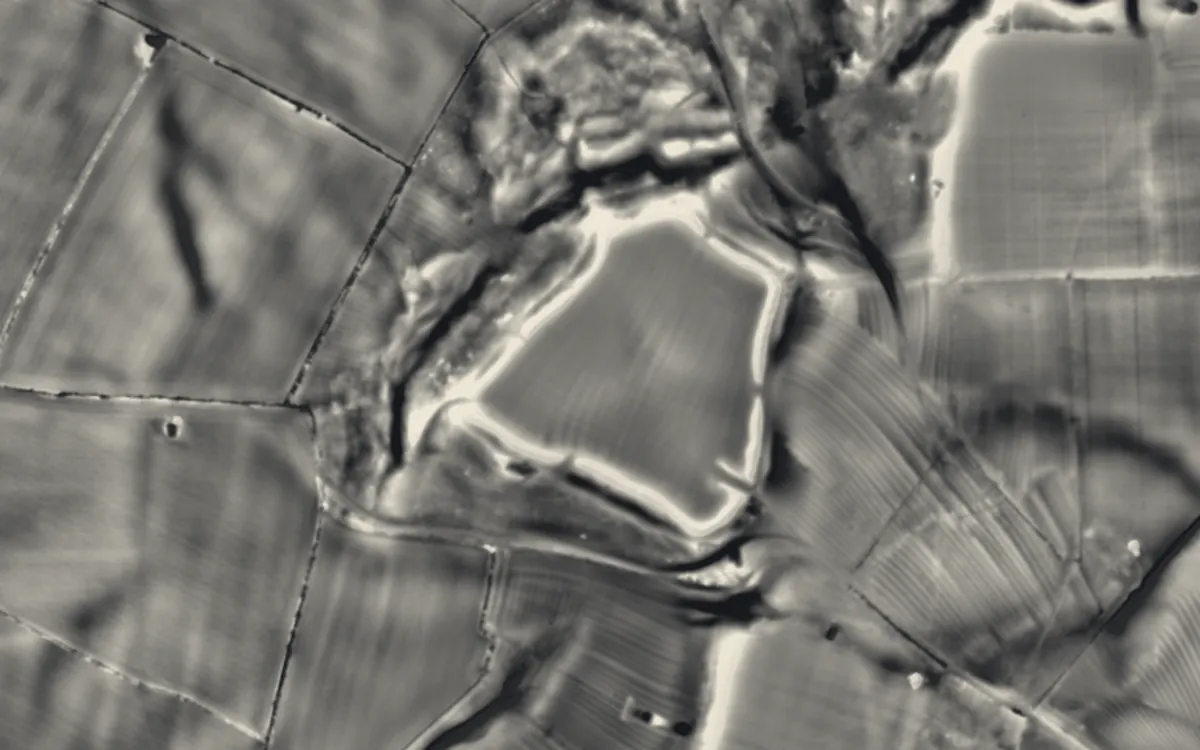
Places on the LiDAR in Leicestershire
Each page shows the site on the LiDAR with its record, its location and the recorded places around it.
- Bradgate HouseScheduled monument
- Burrough HillHillfort
- Donington CastleCastle
- Greyfriars, LeicesterAbbey
- Groby CastleMotte and bailey
- Hallaton CastleMotte and bailey
- Inclined plane immediately east of Foxton LocksScheduled monument
- Kibworth Harcourt MillIndustrial site
- Kirby Bellars PrioryPriory
- Kirby Muxloe CastleFortified manor house
- Moira FurnaceIndustrial site
- Raw DykesScheduled monument
- Sauvey CastleCastle
- St Mary in Arden ChurchChapel or church
- The Bulwarks (earthworks)Hillfort
- Ulverscroft PrioryPriory
LiDAR maps of the parishes of Leicestershire
One page for each of the 239 parishes, with a LiDAR picture and the recorded places inside it.
- Ab Kettleby16 recorded places
- Allexton6 recorded places
- Anstey7 recorded places
- Appleby Magna16 recorded places
- Arnesby5 recorded places
- Asfordby15 recorded places
- Ashby Magna5 recorded places
- Ashby Parva4 recorded places
- Ashby Woulds10 recorded places
- Ashby de la Zouch49 recorded places
- Aston Flamville3 recorded places
- Bagworth & Thornton12 recorded places
- Bardon6 recorded places
- Barkby8 recorded places
- Barkby Thorpe4 recorded places
- Barlestone3 recorded places
- Barrow upon Soar13 recorded places
- Barwell7 recorded places
- Beeby3 recorded places
- Belton8 recorded places
- Belvoir32 recorded places
- Billesdon7 recorded places
- Birstall3 recorded places
- Bitteswell with Bittesby10 recorded places
- Blaby7 recorded places
- Blaston3 recorded places
- Bottesford21 recorded places
- Braunstone6 recorded places
- Breedon on the Hill15 recorded places
- Bringhurst4 recorded places
- Broughton Astley11 recorded places
- Broughton and Old Dalby18 recorded places
- Bruntingthorpe4 recorded places
- Buckminster9 recorded places
- Burbage11 recorded places
- Burton Overy4 recorded places
- Burton and Dalby15 recorded places
- Burton on the Wolds4 recorded places
- Cadeby4 recorded places
- Carlton2 recorded places
- Carlton Curlieu5 recorded places
- Castle Donington26 recorded places
- Catthorpe6 recorded places
- Charley13 recorded places
- Charnwood67 recorded places
- Chilcote4 recorded places
- Clawson, Hose and Harby20 recorded places
- Claybrooke Magna5 recorded places
- Claybrooke Parva5 recorded places
- Cold Newton5 recorded places
- Coleorton21 recorded places
- Cosby4 recorded places
- Cossington14 recorded places
- Cotes6 recorded places
- Cotesbach3 recorded places
- Countesthorpe8 recorded places
- Cranoe4 recorded places
- Croft8 recorded places
- Croxton Kerrial15 recorded places
- Dadlington & Sutton Cheney17 recorded places
- Desford15 recorded places
- Drayton2 recorded places
- Dunton Bassett4 recorded places
- Earl Shilton7 recorded places
- East Goscote1 recorded places
- East Langton6 recorded places
- East Norton7 recorded places
- Eaton18 recorded places
- Ellistown and Battleflat2 recorded places
- Elmesthorpe5 recorded places
- Enderby13 recorded places
- Fleckney3 recorded places
- Foxton11 recorded places
- Freeby24 recorded places
- Frisby4 recorded places
- Frisby on the Wreake7 recorded places
- Frolesworth3 recorded places
- Gaddesby16 recorded places
- Garthorpe5 recorded places
- Gaulby3 recorded places
- Gilmorton9 recorded places
- Glen Parva8 recorded places
- Glenfields15 recorded places
- Glooston3 recorded places
- Goadby4 recorded places
- Great Bowden8 recorded places
- Great Easton11 recorded places
- Great Glen14 recorded places
- Grimston16 recorded places
- Groby8 recorded places
- Gumley8 recorded places
- Hallaton13 recorded places
- Hamilton Lea1 recorded places
- Harborough44 recorded places
- Hathern8 recorded places
- Heather3 recorded places
- Higham on the Hill11 recorded places
- Hinckley and Bosworth18 recorded places
- Hoby with Rotherby21 recorded places
- Horninghold3 recorded places
- Hoton2 recorded places
- Houghton on the Hill7 recorded places
- Hugglescote and Donington le Heath9 recorded places
- Huncote2 recorded places
- Hungarton19 recorded places
- Husbands Bosworth13 recorded places
- Ibstock6 recorded places
- Illston on the Hill2 recorded places
- Isley cum Langley4 recorded places
- Kegworth10 recorded places
- Keyham2 recorded places
- Kibworth Beauchamp7 recorded places
- Kibworth Harcourt6 recorded places
- Kilby8 recorded places
- Kimcote and Walton6 recorded places
- King's Norton4 recorded places
- Kirby Bellars8 recorded places
- Kirby Muxloe7 recorded places
- Kirkby Mallory, Peckleton & Stapleton16 recorded places
- Knaptoft6 recorded places
- Knossington and Cold Overton11 recorded places
- Laughton5 recorded places
- Launde10 recorded places
- Leicester297 recorded places
- Leicester Forest East2 recorded places
- Leicester Forest West1 recorded places
- Leire7 recorded places
- Little Stretton6 recorded places
- Lockington-Hemington24 recorded places
- Loddington4 recorded places
- Long Whatton and Diseworth29 recorded places
- Lowesby14 recorded places
- Lubbesthorpe3 recorded places
- Lubenham16 recorded places
- Lutterworth22 recorded places
- Marefield2 recorded places
- Market Bosworth29 recorded places
- Markfield12 recorded places
- Measham10 recorded places
- Medbourne14 recorded places
- Melton48 recorded places
- Misterton with Walcote8 recorded places
- Mountsorrel12 recorded places
- Mowsley3 recorded places
- Nailstone4 recorded places
- Narborough12 recorded places
- Nevill Holt7 recorded places
- Newbold Verdon8 recorded places
- Newtown Linford16 recorded places
- Normanton le Heath2 recorded places
- North Kilworth7 recorded places
- North West Leicestershire31 recorded places
- Noseley5 recorded places
- Oadby and Wigston32 recorded places
- Oakthorpe and Donisthorpe11 recorded places
- Osbaston3 recorded places
- Osgathorpe5 recorded places
- Owston and Newbold10 recorded places
- Packington9 recorded places
- Peatling Magna5 recorded places
- Peatling Parva2 recorded places
- Potters Marston4 recorded places
- Prestwold5 recorded places
- Queniborough5 recorded places
- Quorn21 recorded places
- Ratby8 recorded places
- Ratcliffe on the Wreake5 recorded places
- Ravenstone with Snibstone13 recorded places
- Rearsby6 recorded places
- Redmile17 recorded places
- Rolleston4 recorded places
- Rothley12 recorded places
- Saddington7 recorded places
- Sapcote9 recorded places
- Scalford11 recorded places
- Scraptoft7 recorded places
- Seagrave5 recorded places
- Shackerstone27 recorded places
- Shangton4 recorded places
- Sharnford7 recorded places
- Shawell7 recorded places
- Shearsby4 recorded places
- Sheepy24 recorded places
- Shepshed17 recorded places
- Sileby9 recorded places
- Skeffington8 recorded places
- Slawston4 recorded places
- Smeeton Westerby6 recorded places
- Snarestone13 recorded places
- Somerby20 recorded places
- South Croxton5 recorded places
- South Kilworth7 recorded places
- Sproxton17 recorded places
- Stanton-under-Bardon4 recorded places
- Stathern7 recorded places
- Staunton Harold11 recorded places
- Stockerston9 recorded places
- Stoke Golding6 recorded places
- Stonebow Village8 recorded places
- Stoney Stanton5 recorded places
- Stonton Wyville4 recorded places
- Stoughton7 recorded places
- Stretton en le Field5 recorded places
- Swannington7 recorded places
- Swepstone and Newton Burgoland6 recorded places
- Swinford6 recorded places
- Swithland14 recorded places
- Syston10 recorded places
- Theddingworth12 recorded places
- Thorpe Langton5 recorded places
- Thrussington6 recorded places
- Thurcaston and Cropston13 recorded places
- Thurlaston5 recorded places
- Thurmaston9 recorded places
- Thurnby and Bushby6 recorded places
- Tilton on the Hill and Halstead14 recorded places
- Tugby and Keythorpe8 recorded places
- Tur Langton8 recorded places
- Twycross20 recorded places
- Twyford and Thorpe8 recorded places
- Ullesthorpe7 recorded places
- Ulverscroft9 recorded places
- Waltham on the Wolds and Thorpe Arnold20 recorded places
- Walton on the Wolds4 recorded places
- Wanlip6 recorded places
- Welham3 recorded places
- West Langton5 recorded places
- Westrill and Starmore11 recorded places
- Whetstone7 recorded places
- Whitwick9 recorded places
- Wigston Parva6 recorded places
- Willoughby Waterleys5 recorded places
- Wistow13 recorded places
- Withcote6 recorded places
- Witherley15 recorded places
- Woodhouse26 recorded places
- Worthington11 recorded places
- Wymeswold10 recorded places
- Wymondham14 recorded places
About the LiDAR
The terrain model is made from an airborne laser survey with vegetation and buildings removed, so earthworks show as height: hillfort ramparts, barrows, Roman road banks, hollow ways and ridge and furrow. In the app the picture is computed as you change the settings, with a moveable sun, a local relief model, multidirectional hillshading and the VAT composite. See how to read a LiDAR map and what archaeology looks like on LiDAR.
Sources
- LiDAR: Environment Agency, 1 m composite DTM, Open Government Licence.
- Recorded places: the national heritage records (Historic England, Cadw, Coflein and others) as held by Waystone.
Last updated 2026-10-16.