LiDAR map of Kent
Waystone shows the bare-earth LiDAR of Kent at one metre per pixel, with the 10,200 recorded historic places the heritage records hold here, the Roman roads and the Ordnance Survey six-inch maps of 1843–1913 over the same ground. Free, in a browser.
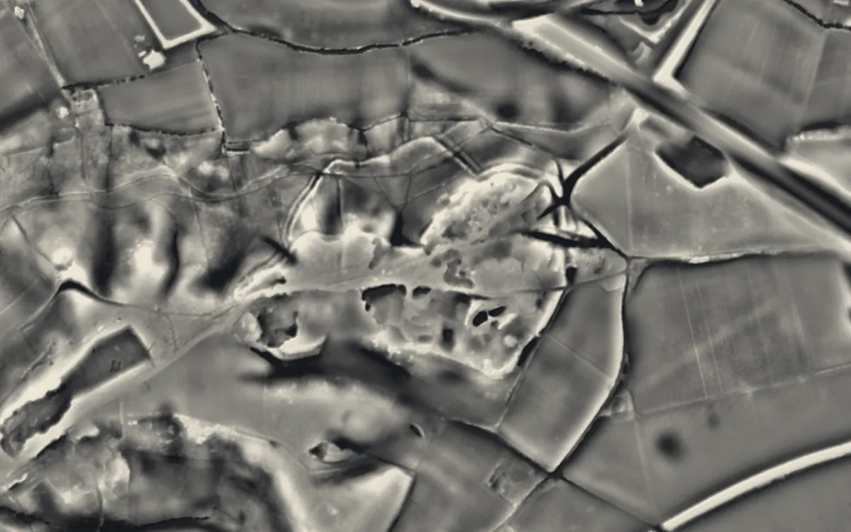
Places on the LiDAR in Kent
Each page shows the site on the LiDAR with its record, its location and the recorded places around it.
- Addington Long BarrowBarrow
- Archcliffe FortMilitary site
- Bigbury CampHillfort
- Bilsington PrioryPriory
- BlackfriarsScheduled monument
- Boxley AbbeyAbbey
- Canterbury CastleCastle
- Canterbury city wallsScheduled monument
- Castra LemanisRoman fort
- Chestnuts long barrowBarrow
- Cliffe FortMilitary site
- Cockham Wood FortMilitary site
- Coldrum Long BarrowBarrow
- College of All Saints, MaidstoneScheduled monument
- Cooling CastleCastle
- Countless StonesBarrow
- Deal CastleCastle
- Domestic chapel at Horne's PlaceChapel or church
- Dover CastleCastle
- Dover PrioryPriory
- Dymchurch Martello TowerScheduled monument
- Dymchurch RedoubtScheduled monument
- East Farleigh BridgeBridge
- Folkestone CastleCastle
- Fort BorstalMilitary site
- Fort BurgoyneMilitary site
- Fort ClarenceMilitary site
- Fort DarnetMilitary site
- Fort HooMilitary site
- Fort HorstedMilitary site
- Fort LutonMilitary site
- Fort PittMilitary site
- Gravesend BlockhouseScheduled monument
- Hope All Saints', remains of churchChapel or church
- Jacket's Field Long BarrowBarrow
- Julliberrie's GraveBarrow
- Kit's Coty HouseBarrow
- Leybourne CastleCastle
- Maison DieuScheduled monument
- Maison DieuScheduled monument
- Old Brook Pumping StationScheduled monument
- Oldbury hillfortHillfort
- Otford CastleScheduled monument
- Queenborough CastleCastle
- Rochester CastleCastle
- Saltwood CastleCastle
- Sandgate CastleCastle
- Sandown CastleCastle
- Shoreham Memorial CrossScheduled monument
- Shorncliffe RedoubtScheduled monument
- Shornemead FortMilitary site
- Shrub's Wood oval barrowBarrow
- St Augustine's AbbeyAbbey
- St Augustine's monastic conduit house, King's ParkScheduled monument
- St James' Church, DoverChapel or church
- St John's Priory, Including The Ruins Of The PrioryPriory
- St Mary's Church, EastwellChapel or church
- Sutton Valence CastleCastle
- Temple ManorScheduled monument
- Teston BridgeBridge
- Thurnham CastleMotte and bailey
- Tithe Barn, MaidstoneScheduled monument
- Tonbridge CastleCastle
- Updown early medieval cemeteryScheduled monument
- Upnor CastleCastle
- Walmer CastleCastle
- Westenhanger CastleCastle
LiDAR maps of the parishes of Kent
One page for each of the 336 parishes, with a LiDAR picture and the recorded places inside it.
- Acol2 recorded places
- Acrise8 recorded places
- Addington8 recorded places
- Adisham14 recorded places
- Aldington16 recorded places
- Alkham19 recorded places
- Allhallows74 recorded places
- Appledore19 recorded places
- Ash76 recorded places
- Ash-cum-Ridley17 recorded places
- Ashford66 recorded places
- Aylesford54 recorded places
- Aylesham16 recorded places
- Badgers Mount1 recorded places
- Badlesmere4 recorded places
- Bapchild2 recorded places
- Barham22 recorded places
- Barming16 recorded places
- Bean4 recorded places
- Bearsted13 recorded places
- Bekesbourne-with-Patrixbourne21 recorded places
- Benenden37 recorded places
- Bethersden16 recorded places
- Bicknor3 recorded places
- Bidborough11 recorded places
- Biddenden24 recorded places
- Bilsington27 recorded places
- Birchington19 recorded places
- Birling3 recorded places
- Bishopsbourne11 recorded places
- Blean10 recorded places
- Bobbing5 recorded places
- Bonnington8 recorded places
- Borden9 recorded places
- Borough Green4 recorded places
- Boughton Aluph17 recorded places
- Boughton Malherbe9 recorded places
- Boughton Monchelsea25 recorded places
- Boughton under Blean18 recorded places
- Boxley57 recorded places
- Brabourne11 recorded places
- Brasted19 recorded places
- Bredgar11 recorded places
- Bredhurst7 recorded places
- Brenchley and Matfield73 recorded places
- Brenzett12 recorded places
- Bridge13 recorded places
- Broadstairs and St. Peters92 recorded places
- Brook6 recorded places
- Brookland12 recorded places
- Broomfield and Kingswood10 recorded places
- Burham10 recorded places
- Burmarsh17 recorded places
- Canterbury315 recorded places
- Capel43 recorded places
- Capel-le-Ferne26 recorded places
- Challock8 recorded places
- Charing43 recorded places
- Chart Sutton5 recorded places
- Chartham28 recorded places
- Chestfield6 recorded places
- Chevening17 recorded places
- Chiddingstone51 recorded places
- Chilham26 recorded places
- Chislet37 recorded places
- Cliffe and Cliffe Woods214 recorded places
- Cliffsend30 recorded places
- Cobham28 recorded places
- Collier Street7 recorded places
- Cooling72 recorded places
- Cowden15 recorded places
- Coxheath3 recorded places
- Cranbrook & Sissinghurst111 recorded places
- Crockenhill8 recorded places
- Crundale10 recorded places
- Cuxton9 recorded places
- Darenth17 recorded places
- Dartford57 recorded places
- Deal48 recorded places
- Denton with Wootton14 recorded places
- Detling7 recorded places
- Ditton11 recorded places
- Doddington6 recorded places
- Dover279 recorded places
- Downswood2 recorded places
- Dunkirk15 recorded places
- Dunton Green8 recorded places
- Dymchurch37 recorded places
- East Farleigh17 recorded places
- East Malling and Larkfield36 recorded places
- East Peckham35 recorded places
- East Sutton8 recorded places
- Eastchurch20 recorded places
- Eastling14 recorded places
- Eastry34 recorded places
- Eastwell4 recorded places
- Edenbridge42 recorded places
- Egerton15 recorded places
- Elham32 recorded places
- Elmsted15 recorded places
- Eynsford21 recorded places
- Eythorne21 recorded places
- Farningham23 recorded places
- Faversham119 recorded places
- Fawkham6 recorded places
- Folkestone163 recorded places
- Fordwich20 recorded places
- Frindsbury Extra53 recorded places
- Frinsted6 recorded places
- Frittenden21 recorded places
- Godmersham17 recorded places
- Goodnestone33 recorded places
- Goudhurst68 recorded places
- Graveney with Goodnestone15 recorded places
- Gravesham150 recorded places
- Great Chart with Singleton33 recorded places
- Great Mongeham7 recorded places
- Guston74 recorded places
- Hackington5 recorded places
- Hadlow84 recorded places
- Halling8 recorded places
- Halstead6 recorded places
- Harbledown and Rough Common12 recorded places
- Harrietsham27 recorded places
- Hartley7 recorded places
- Hartlip8 recorded places
- Hastingleigh8 recorded places
- Hawkhurst55 recorded places
- Hawkinge34 recorded places
- Headcorn32 recorded places
- Herne and Broomfield10 recorded places
- Hernhill17 recorded places
- Hersden7 recorded places
- Hever22 recorded places
- Hextable1 recorded places
- High Halden11 recorded places
- High Halstow76 recorded places
- Higham65 recorded places
- Hildenborough28 recorded places
- Hoath10 recorded places
- Hollingbourne29 recorded places
- Hoo St. Werburgh225 recorded places
- Horsmonden28 recorded places
- Horton Kirby and South Darenth14 recorded places
- Hothfield11 recorded places
- Hougham Without42 recorded places
- Hucking3 recorded places
- Hunton24 recorded places
- Hythe153 recorded places
- Ickham and Well33 recorded places
- Ightham27 recorded places
- Isle of Grain112 recorded places
- Ivychurch6 recorded places
- Iwade7 recorded places
- Kemsing14 recorded places
- Kenardington7 recorded places
- Kennington19 recorded places
- Kings Hill6 recorded places
- Kingsnorth10 recorded places
- Kingston7 recorded places
- Knockholt4 recorded places
- Lamberhurst39 recorded places
- Langdon16 recorded places
- Langley5 recorded places
- Leaveland4 recorded places
- Leeds22 recorded places
- Leigh54 recorded places
- Lenham33 recorded places
- Leybourne6 recorded places
- Leysdown12 recorded places
- Linton19 recorded places
- Little Chart15 recorded places
- Littlebourne11 recorded places
- Longfield and New Barn11 recorded places
- Loose23 recorded places
- Lower Halstow4 recorded places
- Lower Hardres and Nackington7 recorded places
- Luddenham6 recorded places
- Luddesdown4 recorded places
- Lydd82 recorded places
- Lydden14 recorded places
- Lyminge27 recorded places
- Lympne41 recorded places
- Lynsted with Kingsdown24 recorded places
- Maidstone134 recorded places
- Manston10 recorded places
- Marden25 recorded places
- Medway283 recorded places
- Meopham18 recorded places
- Mereworth12 recorded places
- Mersham24 recorded places
- Milstead4 recorded places
- Minster57 recorded places
- Minster-on-Sea13 recorded places
- Molash5 recorded places
- Monks Horton7 recorded places
- Monkton20 recorded places
- Nettlestead16 recorded places
- New Romney43 recorded places
- Newchurch11 recorded places
- Newenden8 recorded places
- Newington30 recorded places
- Newington13 recorded places
- Newnham8 recorded places
- Nonington19 recorded places
- Northbourne32 recorded places
- Norton, Buckland and Stone18 recorded places
- Oare13 recorded places
- Offham15 recorded places
- Old Romney13 recorded places
- Orlestone13 recorded places
- Ospringe13 recorded places
- Otford24 recorded places
- Otham12 recorded places
- Otterden5 recorded places
- Paddlesworth3 recorded places
- Paddock Wood8 recorded places
- Pembury39 recorded places
- Penshurst91 recorded places
- Petham15 recorded places
- Platt10 recorded places
- Plaxtol18 recorded places
- Pluckley20 recorded places
- Postling5 recorded places
- Preston14 recorded places
- Queenborough10 recorded places
- Ramsgate195 recorded places
- Ringwould with Kingsdown45 recorded places
- Ripple10 recorded places
- River16 recorded places
- Riverhead7 recorded places
- Rodmersham7 recorded places
- Rolvenden32 recorded places
- Ruckinge21 recorded places
- Rusthall4 recorded places
- Ryarsh4 recorded places
- Saltwood19 recorded places
- Sandgate40 recorded places
- Sandhurst23 recorded places
- Sandwich124 recorded places
- Sarre20 recorded places
- Seal27 recorded places
- Sellindge6 recorded places
- Selling12 recorded places
- Sevenoaks44 recorded places
- Sevenoaks Weald7 recorded places
- Sevington with Finberry5 recorded places
- Shadoxhurst10 recorded places
- Sheerness38 recorded places
- Sheldwich14 recorded places
- Shepherdswell with Coldred36 recorded places
- Shipbourne6 recorded places
- Sholden48 recorded places
- Shoreham24 recorded places
- Shorne53 recorded places
- Smarden27 recorded places
- Smeeth17 recorded places
- Snargate8 recorded places
- Snodland21 recorded places
- South Willesborough & Newtown11 recorded places
- Southborough14 recorded places
- Southfleet17 recorded places
- Speldhurst95 recorded places
- St. Margaret's at Cliffe142 recorded places
- St. Mary Hoo56 recorded places
- St. Mary in the Marsh56 recorded places
- St. Nicholas at Wade14 recorded places
- Stalisfield7 recorded places
- Stanford9 recorded places
- Stanhope1 recorded places
- Stansted2 recorded places
- Staple14 recorded places
- Staplehurst32 recorded places
- Stelling Minnis7 recorded places
- Stockbury8 recorded places
- Stoke39 recorded places
- Stone11 recorded places
- Stone-cum-Ebony13 recorded places
- Stourmouth16 recorded places
- Stowting15 recorded places
- Sturry22 recorded places
- Sundridge with Ide Hill33 recorded places
- Sutton20 recorded places
- Sutton Valence13 recorded places
- Sutton-at-Hone and Hawley11 recorded places
- Swale40 recorded places
- Swanley8 recorded places
- Swanscombe and Greenhithe25 recorded places
- Swingfield8 recorded places
- Temple Ewell9 recorded places
- Tenterden50 recorded places
- Teston12 recorded places
- Teynham6 recorded places
- Thanet96 recorded places
- Thanington5 recorded places
- Throwley15 recorded places
- Thurnham31 recorded places
- Tilmanstone19 recorded places
- Tonbridge and Malling48 recorded places
- Tonge8 recorded places
- Tovil12 recorded places
- Trottiscliffe10 recorded places
- Tunbridge Wells124 recorded places
- Tunstall7 recorded places
- Ulcombe13 recorded places
- Upchurch10 recorded places
- Upper Hardres3 recorded places
- Vigo2 recorded places
- Walmer92 recorded places
- Waltham6 recorded places
- Warden1 recorded places
- Warehorne20 recorded places
- Wateringbury15 recorded places
- West Farleigh16 recorded places
- West Kingsdown24 recorded places
- West Malling64 recorded places
- West Peckham9 recorded places
- Westbere7 recorded places
- Westerham50 recorded places
- Westgate-on-Sea14 recorded places
- Westwell22 recorded places
- Whitfield15 recorded places
- Wichling3 recorded places
- Wickhambreaux28 recorded places
- Wilmington7 recorded places
- Wingham41 recorded places
- Wittersham13 recorded places
- Womenswold9 recorded places
- Woodchurch18 recorded places
- Woodnesborough28 recorded places
- Wormshill7 recorded places
- Worth72 recorded places
- Wouldham4 recorded places
- Wrotham26 recorded places
- Wye with Hinxhill36 recorded places
- Yalding57 recorded places
About the LiDAR
The terrain model is made from an airborne laser survey with vegetation and buildings removed, so earthworks show as height: hillfort ramparts, barrows, Roman road banks, hollow ways and ridge and furrow. In the app the picture is computed as you change the settings, with a moveable sun, a local relief model, multidirectional hillshading and the VAT composite. See how to read a LiDAR map and what archaeology looks like on LiDAR.
Sources
- LiDAR: Environment Agency, 1 m composite DTM, Open Government Licence.
- Recorded places: the national heritage records (Historic England, Cadw, Coflein and others) as held by Waystone.
Last updated 2026-10-16.