Home LiDAR map Wales Isle of Anglesey
LiDAR map of Isle of Anglesey
Waystone shows the bare-earth LiDAR of Isle of Anglesey at one metre per pixel, with the 1,713 recorded historic places the heritage records hold here, the Roman roads and the Ordnance Survey six-inch maps of 1843–1913 over the same ground. Free, in a browser.
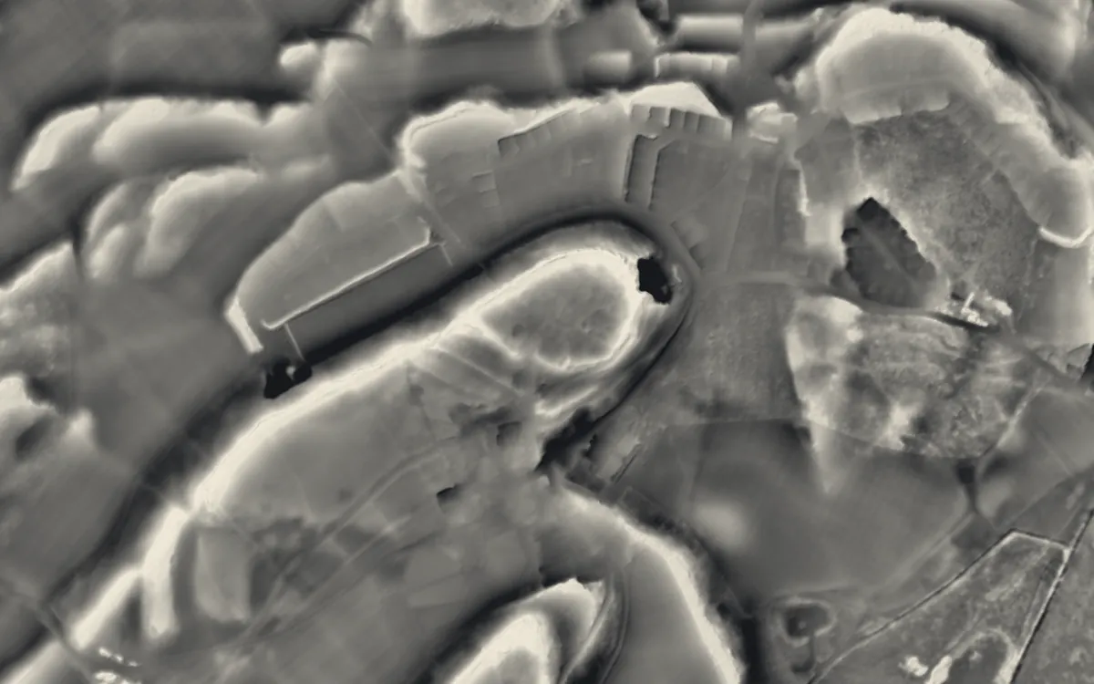
Places on the LiDAR in Isle of Anglesey
Each page shows the site on the LiDAR with its record, its location and the recorded places around it.
- Barclodiad y GawresBarrow
- Beaumaris CastleCastle
- Beaumaris Town WallsScheduled monument
- Bodowyr Burial ChamberBarrow
- Bryn EryrSettlement
- Bryn Gwyn stonesStone circle
- Din Dryfol Chambered TombBarrow
- Din Llugwy Romano-British VillageSettlement
- Henblas Burial ChamberBarrow
- Holyhead Mountain Prehistoric VillageScheduled monument
- Llanddona fish weirScheduled monument
- Llanfaes FriaryScheduled monument
- Llugwy Chambered TombBarrow
- Llys RhosyrScheduled monument
- Old Church of St Nidan, LlanidanChapel or church
- Pant-y-SaerBarrow
- Parciau hill fortHillfort
- Perthi-Duon Burial ChamberScheduled monument
- Porth Wen BrickworksScheduled monument
- Presaddfed Chambered TombBarrow
- St Dwynwen's ChurchChapel or church
- St Gwenfaen's WellScheduled monument
- St Michael's Church, Llanfihangel YsgeifiogChapel or church
- Tŷ Newydd Chambered TombBarrow
LiDAR maps of the communities of Isle of Anglesey
One page for each of the 40 communities, with a LiDAR picture and the recorded places inside it.
- Aberffraw44 recorded places
- Amlwch61 recorded places
- Beaumaris80 recorded places
- Bodedern27 recorded places
- Bodffordd43 recorded places
- Bodorgan44 recorded places
- Bryngwran25 recorded places
- Cwm Cadnant49 recorded places
- Cylch-y-Garn63 recorded places
- Holyhead143 recorded places
- Llanbadrig49 recorded places
- Llanddaniel Fab36 recorded places
- Llanddona30 recorded places
- Llanddyfnan52 recorded places
- Llaneilian41 recorded places
- Llaneugrad15 recorded places
- Llanfachraeth17 recorded places
- Llanfaelog25 recorded places
- Llanfaethlu25 recorded places
- Llanfair Pwllgwyngyll27 recorded places
- Llanfair-Mathafarn-Eithaf48 recorded places
- Llanfair-yn-Neubwll26 recorded places
- Llanfihangel Ysgeifiog37 recorded places
- Llangefni44 recorded places
- Llangoed51 recorded places
- Llangristiolus41 recorded places
- Llanidan43 recorded places
- Llannerch-y-medd32 recorded places
- Mechell41 recorded places
- Menai Bridge34 recorded places
- Moelfre38 recorded places
- Penmynydd25 recorded places
- Pentraeth32 recorded places
- Rhoscolyn24 recorded places
- Rhosybol39 recorded places
- Rhosyr63 recorded places
- Trearddur66 recorded places
- Tref Alaw33 recorded places
- Trewalchmai11 recorded places
- Valley24 recorded places
About the LiDAR
The terrain model is made from an airborne laser survey with vegetation and buildings removed, so earthworks show as height: hillfort ramparts, barrows, Roman road banks, hollow ways and ridge and furrow. In the app the picture is computed as you change the settings, with a moveable sun, a local relief model, multidirectional hillshading and the VAT composite. See how to read a LiDAR map and what archaeology looks like on LiDAR.
Sources
- LiDAR: Natural Resources Wales and Welsh Government, 1 m DTM, Open Government Licence.
- Recorded places: the national heritage records (Historic England, Cadw, Coflein and others) as held by Waystone.
Last updated 2026-10-16.