Home LiDAR map Wales Carmarthenshire
LiDAR map of Carmarthenshire
Waystone shows the bare-earth LiDAR of Carmarthenshire at one metre per pixel, with the 3,811 recorded historic places the heritage records hold here, the Roman roads and the Ordnance Survey six-inch maps of 1843–1913 over the same ground. Free, in a browser.
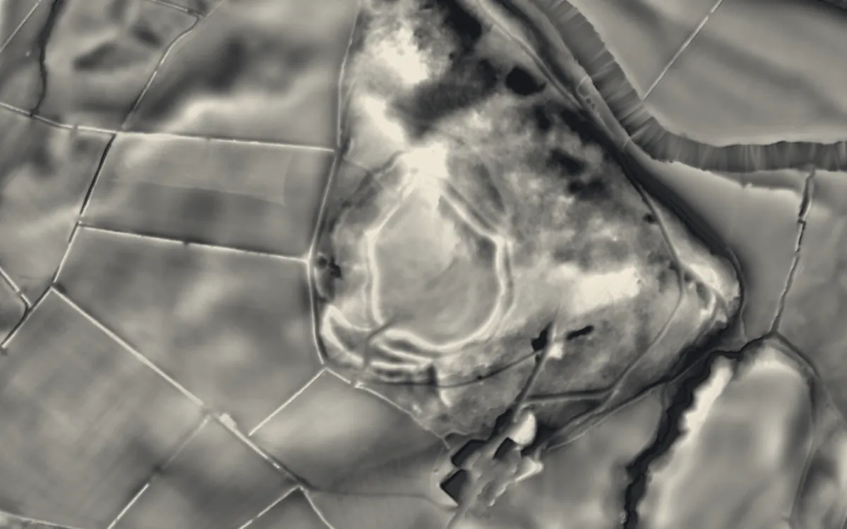
Places on the LiDAR in Carmarthenshire
Each page shows the site on the LiDAR with its record, its location and the recorded places around it.
- Banc y BetwsCastle
- Carmarthen CastleCastle
- Carreg Cennen CastleCastle
- Cenarth BridgeBridge
- Craig GwrtheyrnHillfort
- Dinefwr CastleCastle
- Dolaucothi Gold MinesIndustrial site
- Dolauhirion BridgeBridge
- Hen GapelChapel or church
- Kidwelly CastleCastle
- Laugharne CastleCastle
- Llandovery CastleMotte and bailey
- Llansteffan CastleHillfort
- Newcastle Emlyn CastleCastle
- Priory of St John and St TeulyddogPriory
- St Clears CastleMotte and bailey
- Talley AbbeyAbbey
- The Bridge, bridge StreetBridge
- Whitland AbbeyAbbey
LiDAR maps of the communities of Carmarthenshire
One page for each of the 72 communities, with a LiDAR picture and the recorded places inside it.
- Abergwili36 recorded places
- Abernant14 recorded places
- Ammanford42 recorded places
- Betws30 recorded places
- Bronwydd23 recorded places
- Carmarthen110 recorded places
- Cenarth29 recorded places
- Cilycwm197 recorded places
- Cilymaenllwyd44 recorded places
- Cwmamman63 recorded places
- Cyngor Bro Dyffryn Cennen80 recorded places
- Cynwyl Elfed55 recorded places
- Cynwyl Gaeo190 recorded places
- Eglwyscummin41 recorded places
- Gorslas24 recorded places
- Henllanfallteg27 recorded places
- Kidwelly54 recorded places
- Laugharne Township44 recorded places
- Llanarthney50 recorded places
- Llanboidy81 recorded places
- Llanddarog21 recorded places
- Llanddeusant112 recorded places
- Llanddowror36 recorded places
- Llandeilo63 recorded places
- Llandovery48 recorded places
- Llandybie70 recorded places
- Llandyfaelog47 recorded places
- Llanedi46 recorded places
- Llanegwad49 recorded places
- Llanelli136 recorded places
- Llanelli Rural147 recorded places
- Llanfair-ar-y-bryn108 recorded places
- Llanfihangel Aberbythych51 recorded places
- Llanfihangel Rhos-y-Corn27 recorded places
- Llanfihangel-ar-Arth48 recorded places
- Llanfynydd27 recorded places
- Llangadog149 recorded places
- Llangain20 recorded places
- Llangathen36 recorded places
- Llangeler105 recorded places
- Llangennech25 recorded places
- Llangunnor42 recorded places
- Llangyndeyrn46 recorded places
- Llangynin11 recorded places
- Llangynog23 recorded places
- Llanllawddog19 recorded places
- Llanllwni20 recorded places
- Llannon51 recorded places
- Llanpumsaint21 recorded places
- Llansadwrn25 recorded places
- Llansawel14 recorded places
- Llansteffan45 recorded places
- Llanwinio16 recorded places
- Llanwrda26 recorded places
- Llanybydder30 recorded places
- Llanycrwys10 recorded places
- Manordeilo and Salem48 recorded places
- Meidrim20 recorded places
- Myddfai84 recorded places
- Newcastle Emlyn12 recorded places
- Newchurch and Merthyr26 recorded places
- Pembrey and Burry Port Town153 recorded places
- Pencarreg28 recorded places
- Pendine11 recorded places
- Pontyberem20 recorded places
- Quarter Bach145 recorded places
- St. Clears68 recorded places
- St. Ishmael33 recorded places
- Talley28 recorded places
- Trelech29 recorded places
- Trimsaran42 recorded places
- Whitland22 recorded places
About the LiDAR
The terrain model is made from an airborne laser survey with vegetation and buildings removed, so earthworks show as height: hillfort ramparts, barrows, Roman road banks, hollow ways and ridge and furrow. In the app the picture is computed as you change the settings, with a moveable sun, a local relief model, multidirectional hillshading and the VAT composite. See how to read a LiDAR map and what archaeology looks like on LiDAR.
Sources
- LiDAR: Natural Resources Wales and Welsh Government, 1 m DTM, Open Government Licence.
- Recorded places: the national heritage records (Historic England, Cadw, Coflein and others) as held by Waystone.
Last updated 2026-10-16.